
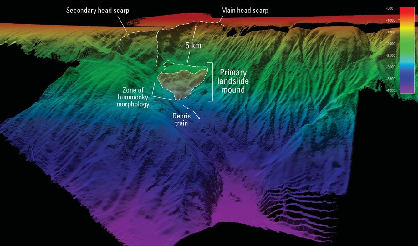
3D perspective map of the seafloor on the southern Aleutian Shelf
By Volcano Science Center
June 2025 (approx.)
Detailed Description
Colored 3D perspective map of the seafloor on the southern Aleutian Shelf, approximately 18 miles south of Little Tanaga and Umak Islands, Alaska. Colors shows depth, ranging from the shallow shelf 1600 feet (500 meters) below sea level in red, to the deep seafloor 13,000 feet (4000 meters) below sea level in purple. The data was collected using the Office of Naval Research’s Research Vessel (R/V) Atlantis multibeam sonar. The area of the newly discovered submarine landslide is shown in the closed dash shaded line.
Sources/Usage
Public Domain.