
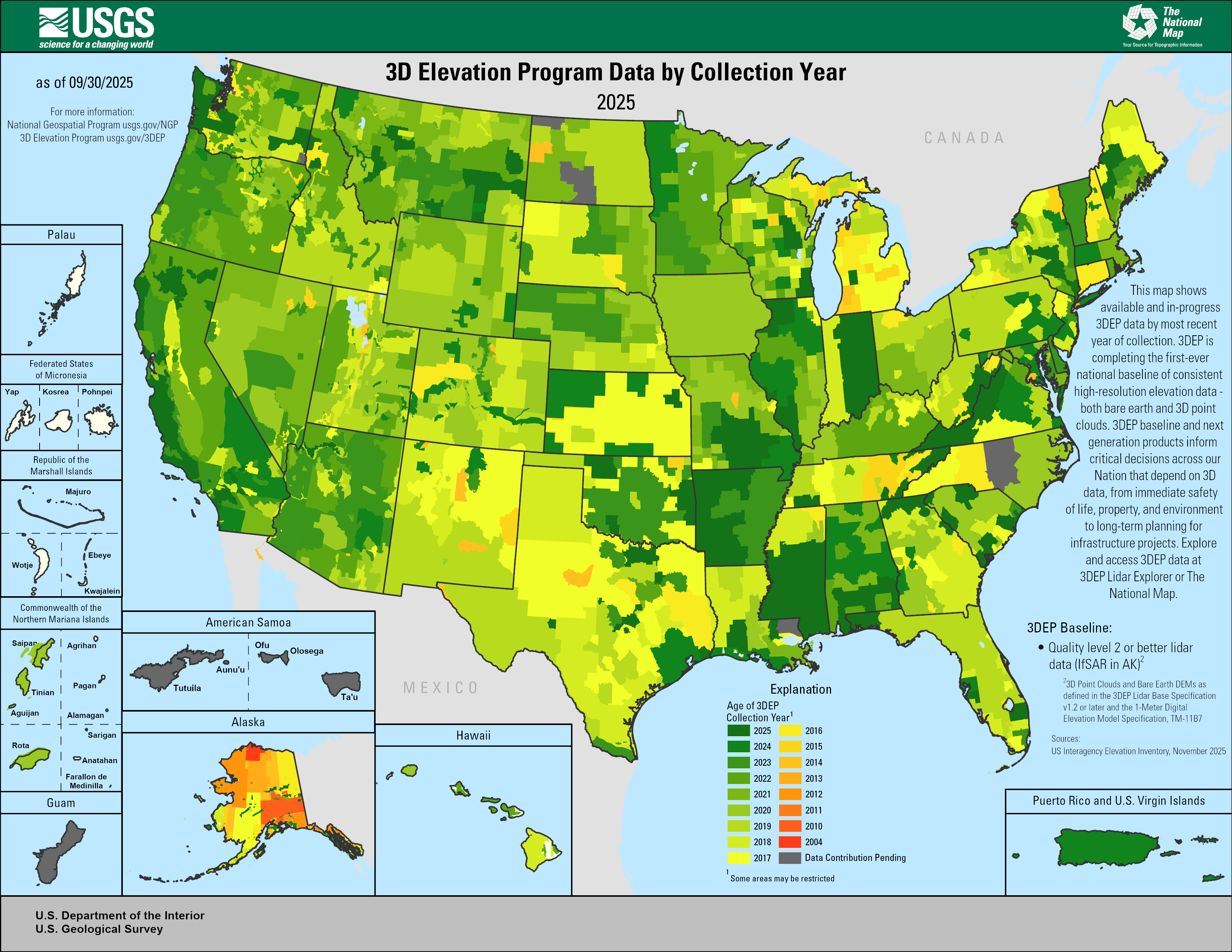
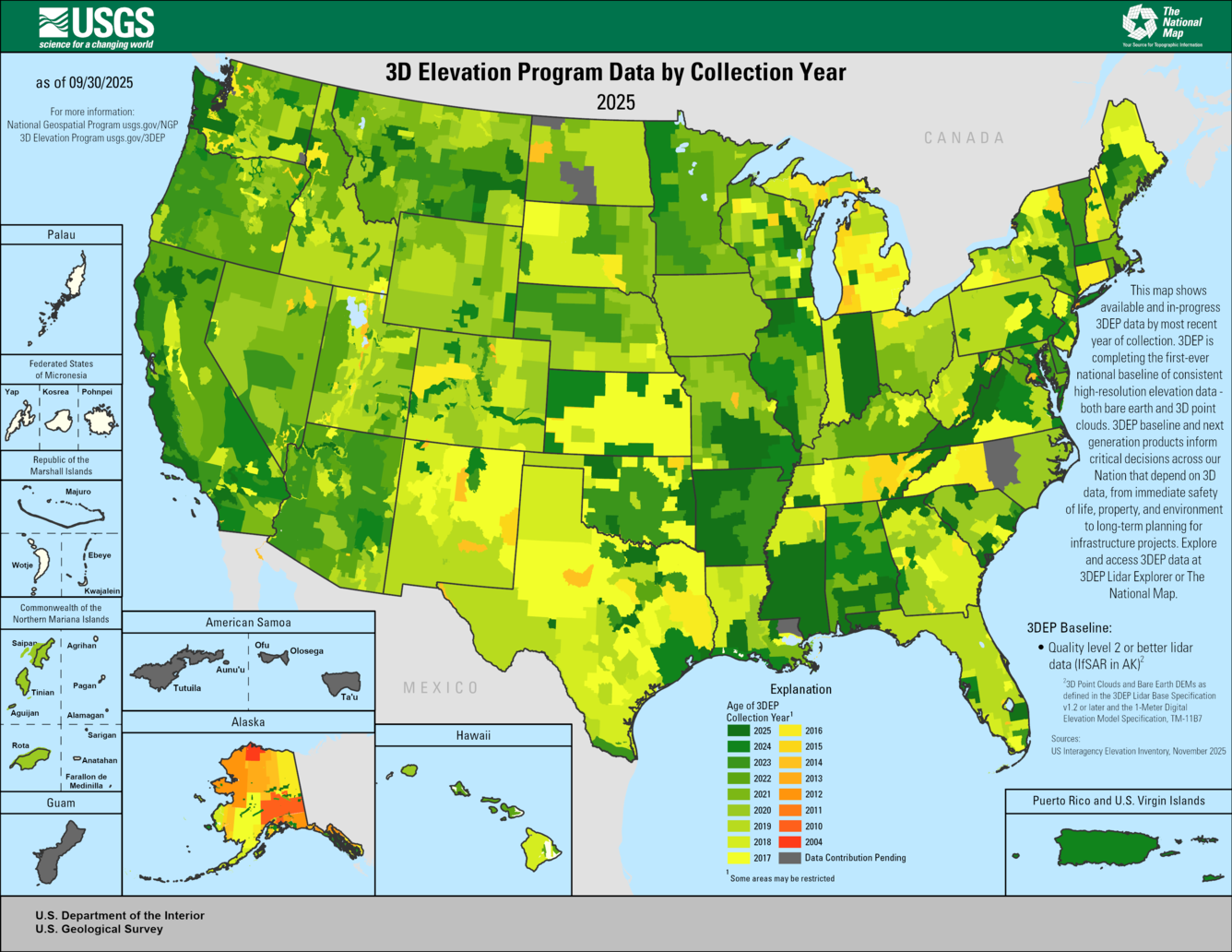
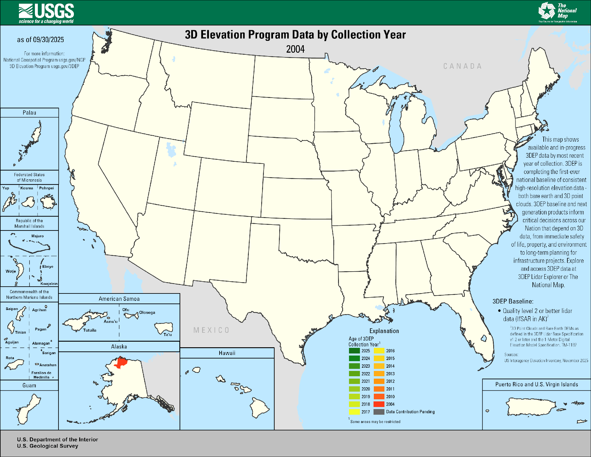
This animated GIF is a map of the United States and its territories shows geographic extent of planned, existing, and in-progress 3DEP data acquisition projects by year.
3DEP Quality Data by Collection Year
Detailed Description
Map shows geographic extent of completion of the first-ever national baseline of consistent high-resolution elevation data - both bare earth and 3D point clouds. FY25 projects are the result of project submissions accepted through the 3D National Topography Model (3DNTM) Data Collaboration Announcement (DCA) and through ongoing Federal coordination via the 3DEP Working Group and include both baseline and next generation 3DEP products.
Explanation
Age of 3DEP
Available or in-progress data that meet 3DEP specification
Dark Green through Red: 2025 - 2004
Dark Gray: Data Contribution Pending
3DEP Specifications
- Quality level 2 or better lidar data (IfSAR in AK) as defined in USGS Lidar Base Specification v1.2 or later
- Publicly available
*Sources: 3DEP FY24 Data Collaboration Announcement, USIEI data from November 2025
Sources/Usage
Public Domain.
Related
3DEP Quality Data by Collection Year Animated GIF
This animated GIF is a map of the United States and its territories shows geographic extent of planned, existing, and in-progress 3DEP data acquisition projects by year.
Related
3DEP Quality Data by Collection Year Animated GIF
This animated GIF is a map of the United States and its territories shows geographic extent of planned, existing, and in-progress 3DEP data acquisition projects by year.
This animated GIF is a map of the United States and its territories shows geographic extent of planned, existing, and in-progress 3DEP data acquisition projects by year.