
3DEP Quality Data by Collection Year Animated GIF
Detailed Description
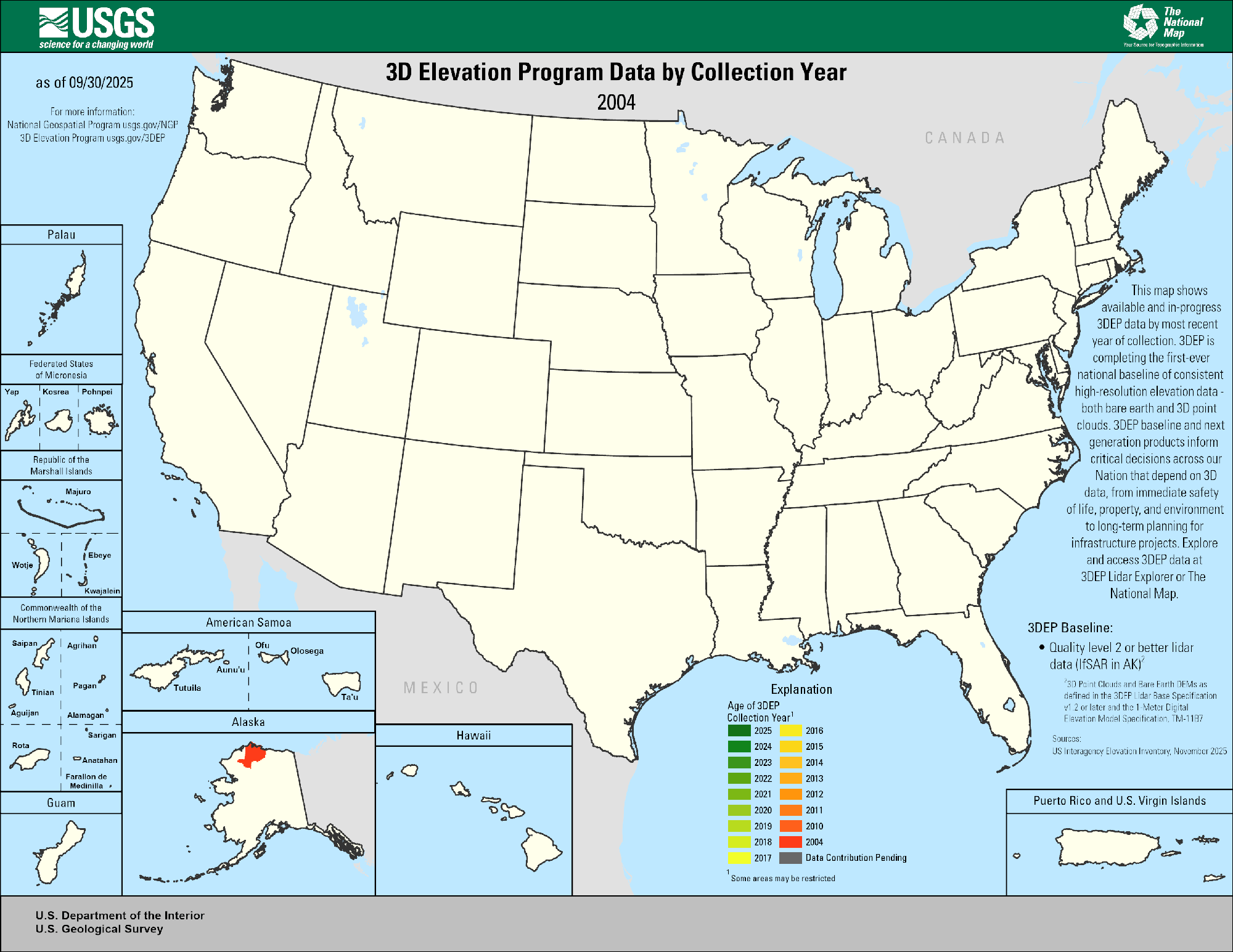
This animated GIF is a map of the United States and its territories shows geographic extent of planned, existing, and in-progress 3DEP data acquisition projects by year. FY25 projects are the result of partnership projects awarded through the FY25 3D Elevation Program (3DEP) Data Collaboration Announcement (DCA) and through on-going Federal coordination via the 3DEP Working Group.
Explanation
Age of 3DEP
Available or in-progress data that meet 3DEP specification
Dark Green through Red: 2025 - 2004
Dark Gray: Data Contribution Pending
3DEP Specifications
- Quality level 2 or better lidar data (IfSAR in AK) as defined in USGS Lidar Base Specification v1.2 or later
- Publicly available
*Sources: 3DEP FY25 Data Collaboration Announcement, USIEI data from November 2025
Sources/Usage
Public Domain.