U.S. flag

An official website of the United States government

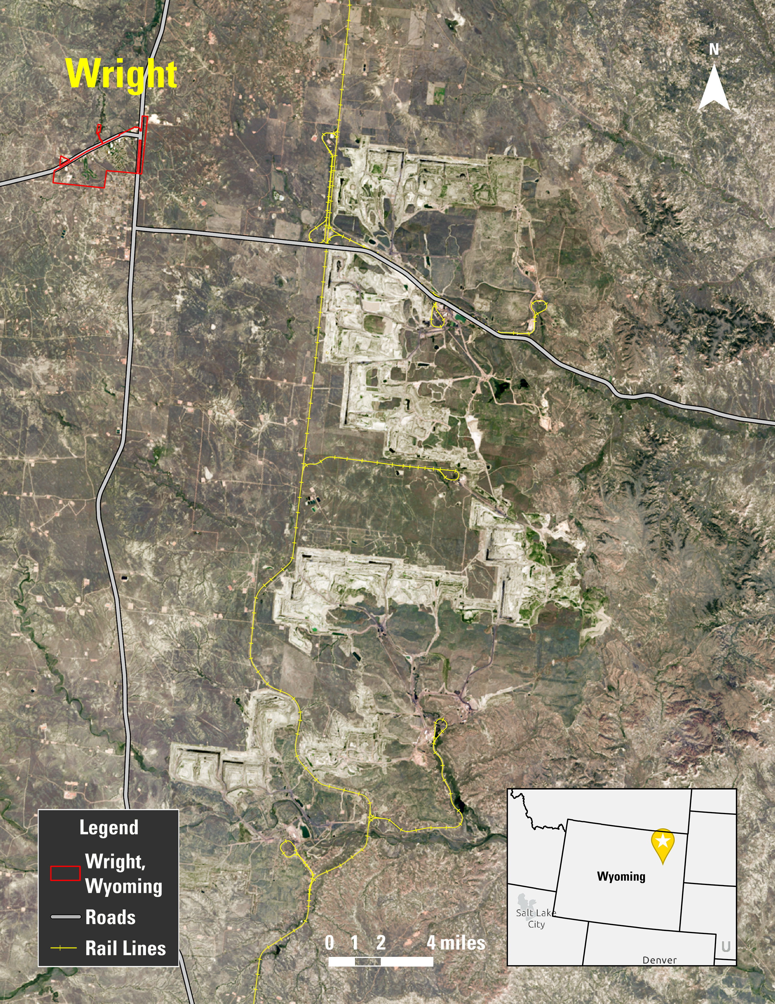
A map of part of the Powder River Basin, including Thunder Basin National Grassland areas in Wyoming

Detailed Description

A map showing mining in part of the Powder River Basin, including Thunder Basin National Grassland areas in Wyoming. Included on the map is the town of Wright, Wyoming. The underlying map image is the intellectual property of Esri and is used herein under license. Copyright © 2026 Esri and its licensors. All rights reserved.

Sources/Usage

Map image is the intellectual property of Esri and is used herein under license. Copyright © 2026 Esri and its licensors. All rights reserved.

Was this page helpful?