
A view of mining in the Powder River Basin using Landsat and Annual NLCD
Detailed Description
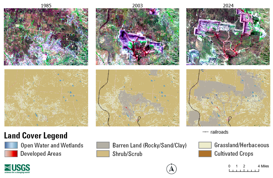
A view of mining-related land changes in the Powder River Basin in 1985, 2003 and 2024 from Landsat satellite data, top row, and the Landsat-derived Annual National Land Cover Database (NLCD), bottom row. This shows landscape (grassland and pasture) before mining began in an area, the beginnings of mining (gray), and the shift in mining out of one area (where the land was then reclaimed to its previous use) and into another area.
Sources/Usage
Public Domain.