



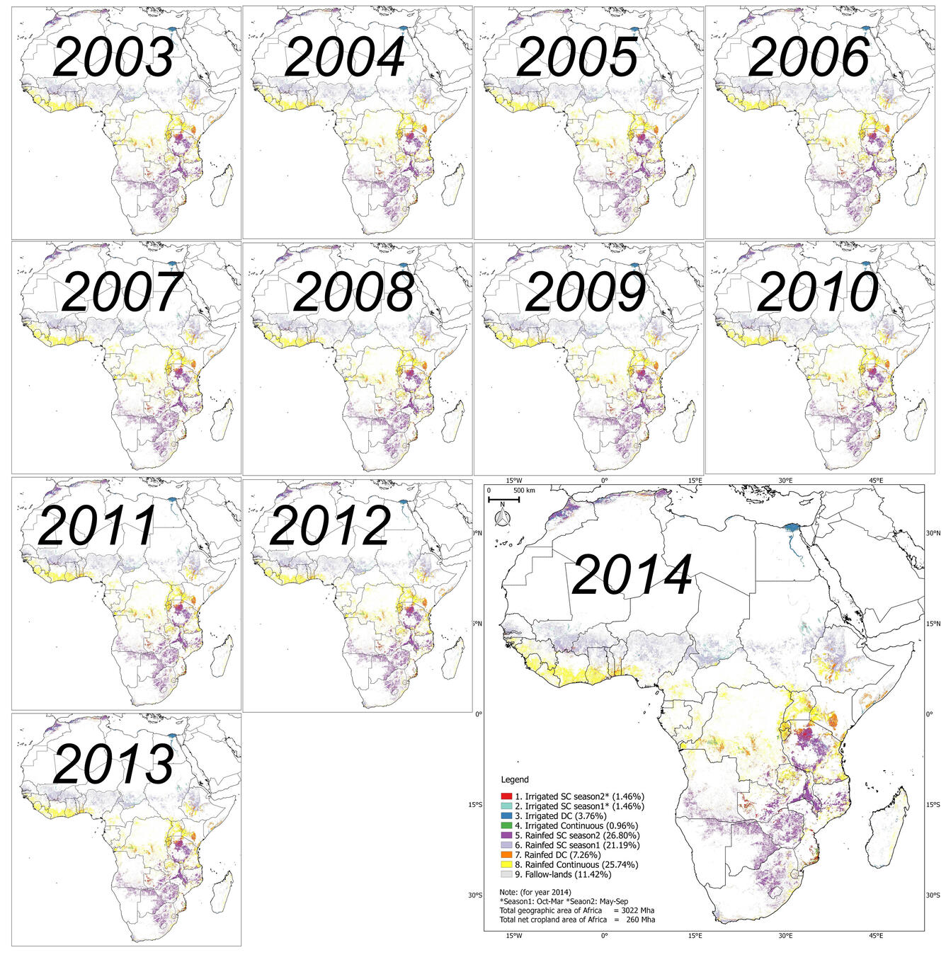
ACM2016 derived cropland products of Africa year after year


Detailed Description
ACM2016 derived cropland products of Africa year after year from year 2003 through the year 2014
Sources/Usage
Public Domain.
Related

Automated Cropland Mapping Algorithm (ACMA) for Africa using Moderate Resolution Imaging Spectroradiometer (MODIS) NDVI Time-series
This repo contains an automated cropland mapping algorithm (ACMA) for Africa using Moderate Resolution Imaging Spectroradiometer (MODIS) NDVI Time-series dataset, implemented by Google Earth Engine (GEE) JavaScript API. In general, this exact code was used by Jun Xiong to generate 250m global cropland product (GCP250m) for continental Africa. You can also read more on ACM2016 in a paper (Xiong and...
Related
Automated Cropland Mapping Algorithm (ACMA) for Africa using Moderate Resolution Imaging Spectroradiometer (MODIS) NDVI Time-series
This repo contains an automated cropland mapping algorithm (ACMA) for Africa using Moderate Resolution Imaging Spectroradiometer (MODIS) NDVI Time-series dataset, implemented by Google Earth Engine (GEE) JavaScript API. In general, this exact code was used by Jun Xiong to generate 250m global cropland product (GCP250m) for continental Africa. You can also read more on ACM2016 in a paper (Xiong and...