
Animation of Landsat images of ships in U.S. harbors
Detailed Description
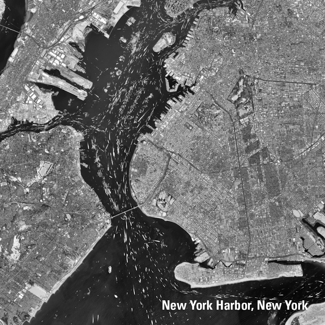
By layering over 10 years of cloud-free Landsat 8 and Landsat 9 images, we can see the bright trails of ship traffic in major U.S. ports and harbors. Check out these striking patterns from popular shipping waterways, captured using Landsat’s panchromatic band. Just another example of how Landsat helps us understand the world from above.
Sources/Usage
Public Domain.