
Apalachicola River Watershed and Bay
Detailed Description
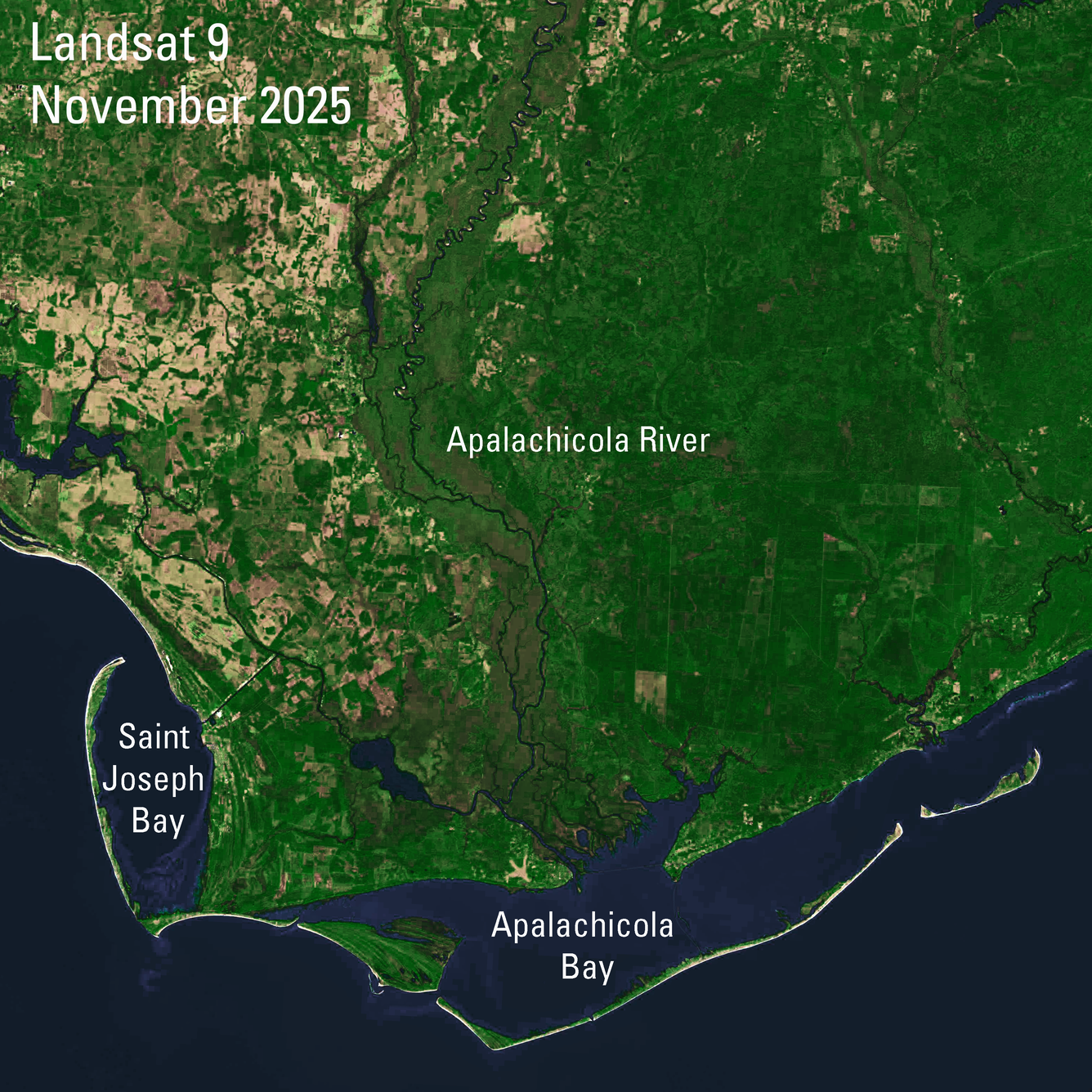
This Landsat 9 image shows the Apalachicola River and the Apalachicola Bay in Florida’s Panhandle. The river —Florida’s largest in terms of water volume discharge— follows the western boundary of heavy forest and is home to great diversity of freshwater fish species.
The river flows into the Apalachicola Bay, a lagoon wetland that contains tidal marshes and seagrass, and is enclosed by barrier islands. The bay supports a wide variety of wildlife, including oysters, fish, birds, and manatees, and is a breeding ground for loggerhead turtles. Saint Joseph Bay, also visible in this image, is known for abundant scallop habitats.
Landsat 9
Path 18 Row 39 acquired November 13, 2025
Path 19 Row 39 acquired November 20, 2025
Bands 6,5,4
Learn more about Landsat: https://www.usgs.gov/landsat-missions.
Sources/Usage
Public Domain.