
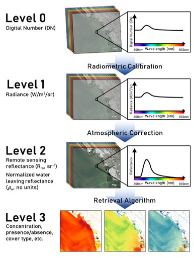
Aquatic Remote Sensing - Schematic of the levels of data and processing steps for satellite imagery

Detailed Description
A schematic of the levels of data and processing steps that imagery go through on their way to becoming data products.
Sources/Usage
Public Domain.