
Aquinnah Time Series
By Woods Hole Coastal and Marine Science Center
September 2025 (approx.)

Detailed Description
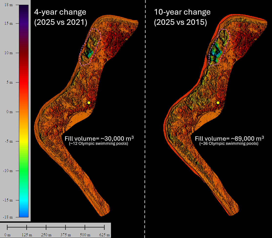
The USGS Aerial Imaging and Mapping Group (AIMG) collaborated with the Wampanoag Tribe of Gay Head (Aquinnah), the Town of Aquinnah, and the Aquinnah Police Department to collect high-resolution data of the Gay Head Cliffs. With permission from the Tribe, the AIMG used uncrewed aircraft systems to document the cliffs in detail to better understand their geologic past, present, and future. The cliffs are sacred and not publicly accessible, so a Tribal representative accompanied the AIMG throughout the data-collection process--ensuring all protocols were followed and work was conducted with respect for the cultural and environmental significance of the site.
Sources/Usage
Public Domain.