
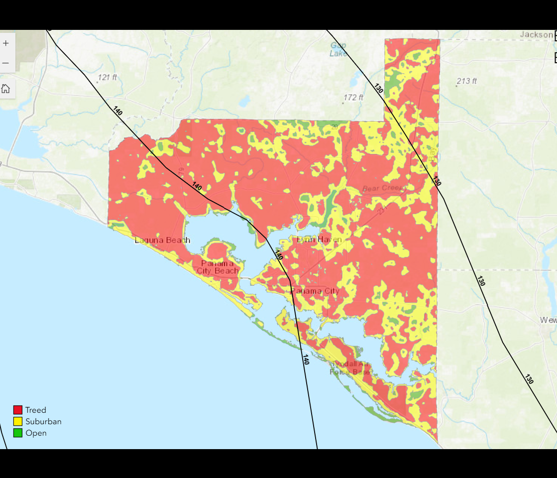
An ARA surface roughness map of Bay County, Florida, based on NLCD classifications

Detailed Description
This map from Applied Research Associates (ARA) Inc. shows the surface roughness categories (open, suburban, treed) used for Bay County, Florida, in the Panhandle region. The categories are based on National Land Cover Database classifications. Image used with permission from Applied Research Associates Inc.
Sources/Usage
This image is used with permission from Applied Research Associates Inc. for a Landsat at Work article about hurricane modeling.