
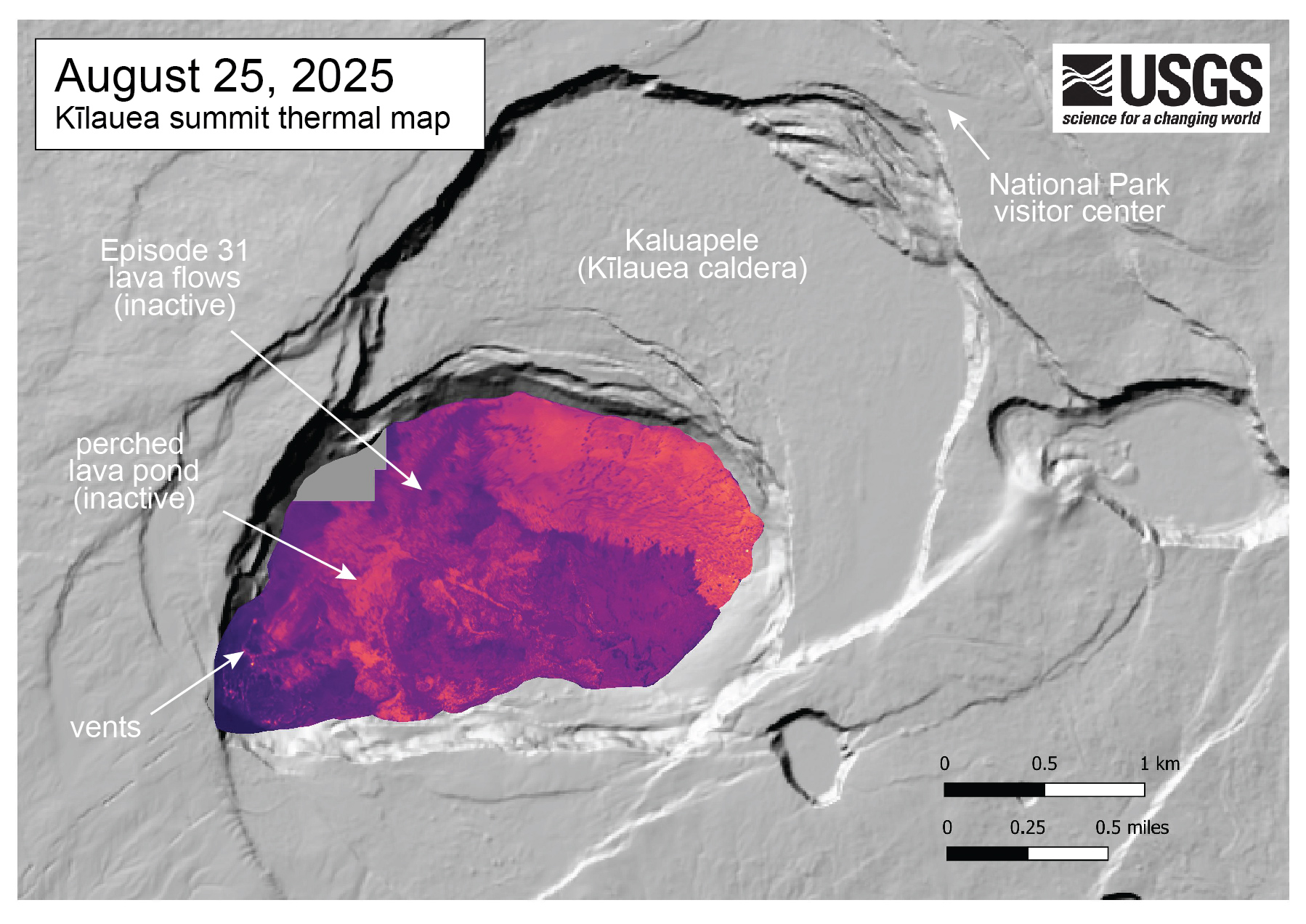
August 25, 2025 — Thermal map of Kīlauea summit following episode 31 lava flows

Detailed Description
This thermal map of Kīlauea's summit caldera was made from airborne thermal images collected on August 25, just a few days after episode 31 lava fountaining covered Halemaʻumaʻu crater floor in new lava flows. These flows remain warm in the thermal imagery, particularly in the eastern crater where flows slightly expanded the margin of new flows on the crater floor. Two tiny ooze-outs of recent lava show as white (hot) in the thermal map, and represent a small amount of residual lava squeezed out from the surface.
Sources/Usage
Public Domain.