
AVIRIS spectrometer images of the San Luis Valley, Colorado
By Geology, Geophysics, and Geochemistry Science Center
1995 (approx.)
Detailed Description
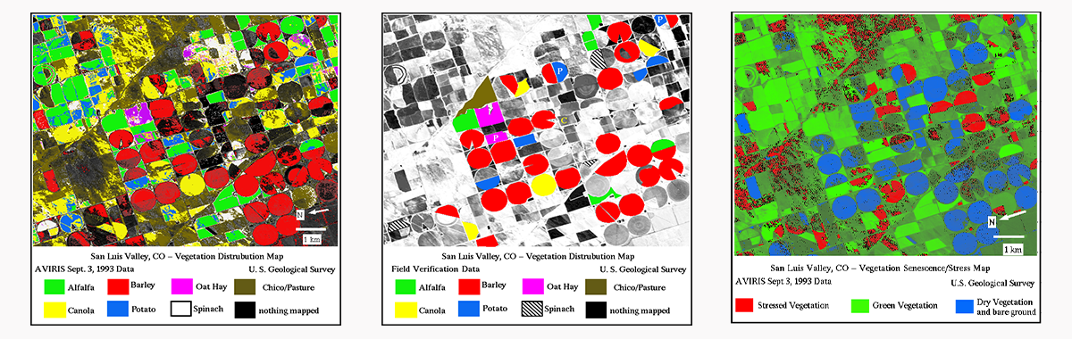
Spectroscopic analysis of Airborne Visual and Infra-Red Imaging Spectrometer (AVIRIS) data mapping vegetation species and senescence/stress collected over the San Luis Valley up to the Summitville abandoned mine in Colorado on September 3, 1993.
Sources/Usage
Public Domain.
Figures 3,4, and 5
Clark, R.N., King, T.V.V., Ager, C., and Swayze, G.A., 1995, Initial vegetation species and senescence/stress mapping in the San Luis Calley, Colorado using imaging spectrometer data. Proceedings: Summitville Forum '95, H.H. Posey, J.A. Pendelton, and D. Van Zyl Eds., Colorado Geological Survey Special Publication 38, p. 64-69.