
Geology, Geophysics, and Geochemistry Science Center
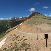
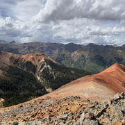
Welcome to the Geology, Geophysics, and Geochemistry Science Center (GGGSC) located in Lakewood, Colorado on the Denver Federal Center. At GGGSC, we apply expertise in geology, geophysics, and geochemistry to interdisciplinary efforts in support of the USGS mission to address the Nation’s important earth science issues, with an emphasis on rare earth mineral resources.
Laboratories
Laboratories

Our center has several laboratories, ranging from geophysics to geochemistry to spectroscopy to scanning electron microscopes.
Science Branches
Science Branches
Our strong science portfolio integrates regional and economic geology with a broad range of geophysical, geochemical, analytical expertise. Our center has four scientific branches:
News
Department of the Interior launches effort to recover critical minerals from mine waste
Department of the Interior launches effort to recover critical minerals from mine waste
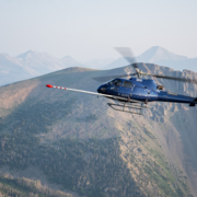
Low-Level Flights to Image Geology Over Parts of Louisiana, Mississippi, and Illinois
Low-Level Flights to Image Geology Over Parts of Louisiana, Mississippi, and Illinois
Recently completed geophysical survey will help protect critical infrastructure from geomagnetic storms and space weather
Recently completed geophysical survey will help protect critical infrastructure from geomagnetic storms and space weather
Publications
The saline groundwater legacy of a large buried coastal paleo-estuary The saline groundwater legacy of a large buried coastal paleo-estuary
Elevated groundwater salinity in coastal regions threatens the beneficial use of fresh groundwater. Coastal groundwater management typically focuses on preventing intrusion from modern sources of seawater; however, past geological processes can also leave a legacy of saline groundwater now hidden in the subsurface. Here, multiple extensive airborne electromagnetic surveys provide...
Mid-Cretaceous porphyritic magmatism in the Beartooth Mountains of the northern Laramide foreland and its connection to Frontier Formation sediment dispersal in Bighorn basin, Montana-Wyoming (USA), and Cordilleran tectonism Mid-Cretaceous porphyritic magmatism in the Beartooth Mountains of the northern Laramide foreland and its connection to Frontier Formation sediment dispersal in Bighorn basin, Montana-Wyoming (USA), and Cordilleran tectonism
Porphyritic intrusions in the southeast Beartooth Mountains and porphyritic cobbles from the Torchlight conglomerate of the Cenomanian Frontier Formation in Bighorn basin (Montana-Wyoming, USA) bear striking resemblance. We utilize geologic mapping, petrography, geochemistry, and geochronology to characterize rocks from both locations and test whether the Beartooth Mountains area was the
Science
Geophysical and Geological Characterization of Mineral Deposit Localization in the Colorado Mineral Belt and Surrounding Lithosphere: Isotope Geochemistry & Geochronology
Isotope geochemistry and geochronology are critical tools in Earth sciences. Sophisticated analytical measurements allow us to understand when and how rocks and minerals formed, helping build models of how tectonic forces built the Earth’s crust through magmatism, when critical mineral deposits formed and how geological processes concentrated metals in the Earth at concentrations economically...
Geophysical and Geological Characterization of Mineral Deposit Localization in the Colorado Mineral Belt and Surrounding Lithosphere: Data Integration, Synthesis, and Visualization
The Colorado Mineral Belt and surrounding region are exceptionally rich in new and legacy data, presenting new opportunities to address the relationship between lithospheric evolution and mineral deposit formation through novel data synthesis, visualization, and mineral resources.
Geophysical and Geological Characterization of Mineral Deposit Localization in the Colorado Mineral Belt and Surrounding Lithosphere: Geophysical Data Analyses and Interpretations
Many of the questions about the origin of the Colorado Mineral Belt (CMB) extend underground. What path did ore-bearing fluids take to their final locations? How did they interact with preexisting structures like faults and fractures? Geophysical methods that allow us to "see" beneath the surface are powerful tools for answering these questions. We plan to use existing seismic data as well as the...