
California active groundwater level netwok
Detailed Description
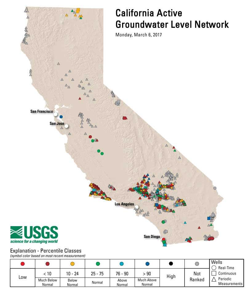
The USGS Active Groundwater Level Network contains water levels and well information from more than 2,000 wells in California that have been measured by the USGS or USGS cooperators at least once within the past 13 months. This network includes all of these wells, regardless of measurement frequency, aquifer monitored, or the monitoring objective. These wells are measured for a variety of disparate purposes, such as statewide monitoring programs, or more local effects like monitoring well drawdown, hydrologic research, aquifer tests, or even earthquake effects on water levels. Information about these wells is available to the world via NWISWeb.
Sources/Usage
Public Domain.