
Chance of Damage Forecasted from an Earthquake During 2018

Detailed Description
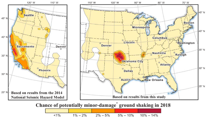
Chance of damage forecasted from an earthquake during 2018.
Sources/Usage
Public Domain.
Related

Hazard Estimation for Induced Earthquakes
In 2016, 2017, and 2018, the USGS released induced earthquake hazard models. These models forecast the expected strength and frequency of potential ground shaking from future induced and natural earthquakes for a one-year period, based primarily on earthquake data from the previous year. Areas of high induced earthquake hazard were identified in Oklahoma-southern Kansas, the Raton Basin (CO/NM...
Related
Hazard Estimation for Induced Earthquakes
In 2016, 2017, and 2018, the USGS released induced earthquake hazard models. These models forecast the expected strength and frequency of potential ground shaking from future induced and natural earthquakes for a one-year period, based primarily on earthquake data from the previous year. Areas of high induced earthquake hazard were identified in Oklahoma-southern Kansas, the Raton Basin (CO/NM...