
Comparison of simulated flood-inundation extents for Muddy River, near Moapa, Nevada
Detailed Description
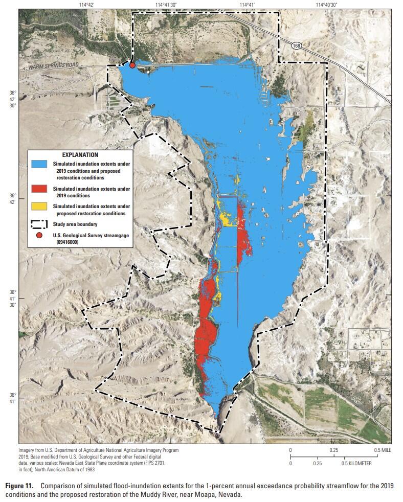
Comparison of simulated flood-inundation extents areas for the 1-percent annual exceedance probability streamflow for 2019 conditions and proposed restoration of the Muddy River, near Moapa, Nevada. The map shows simulated flood-inundation extents for current conditions and proposed restored conditions.
Sources/Usage
Public Domain.
Related

Streamflow Modeling Studies in Nevada
The USGS Nevada Water Science Center (NVWSC), in partnership with the Bureau of Land Management (BLM), is conducting hydrologic and hydraulic modeling studies to support stream restoration.
Related
Streamflow Modeling Studies in Nevada
The USGS Nevada Water Science Center (NVWSC), in partnership with the Bureau of Land Management (BLM), is conducting hydrologic and hydraulic modeling studies to support stream restoration.