



Cropland per Capita
Detailed Description
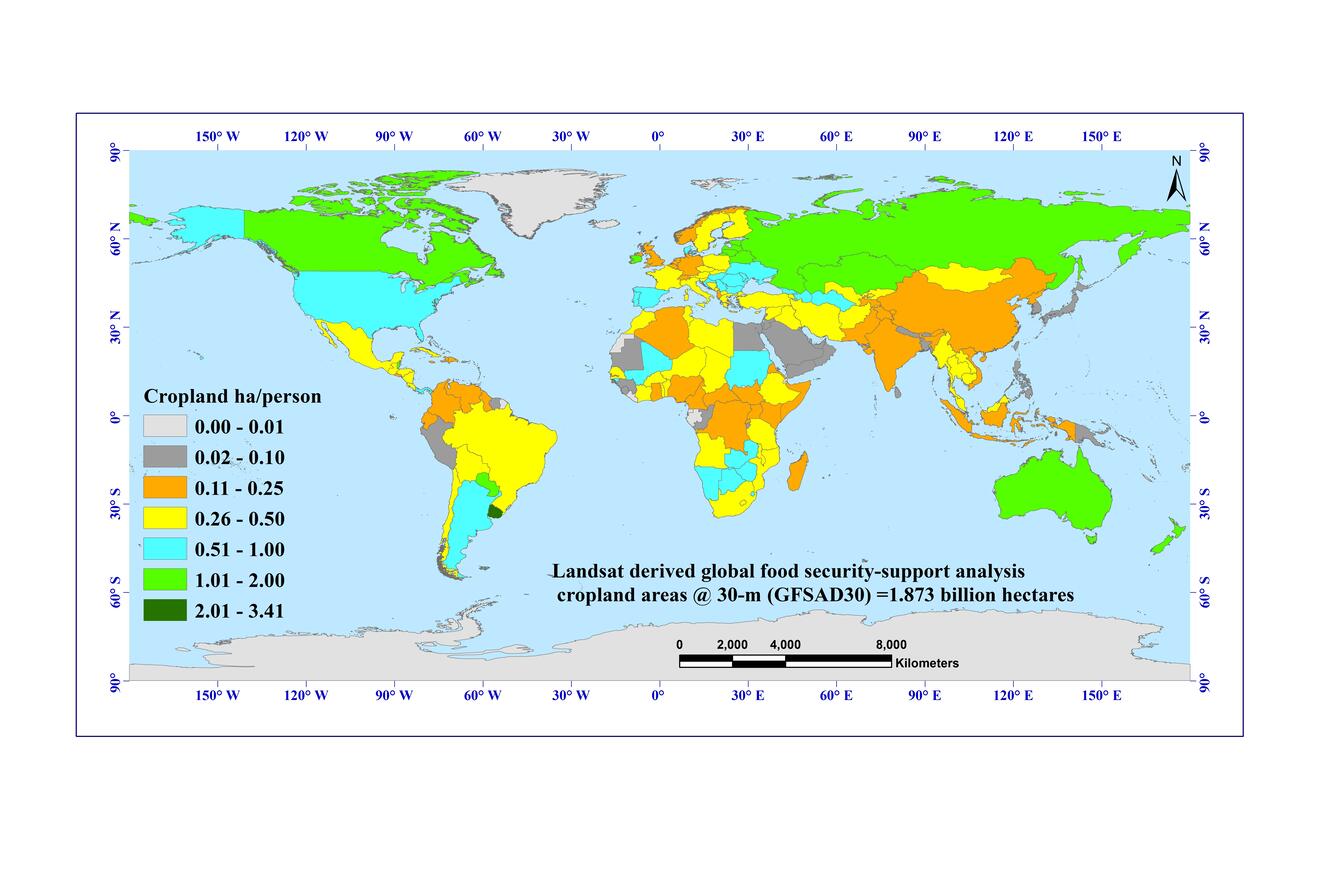
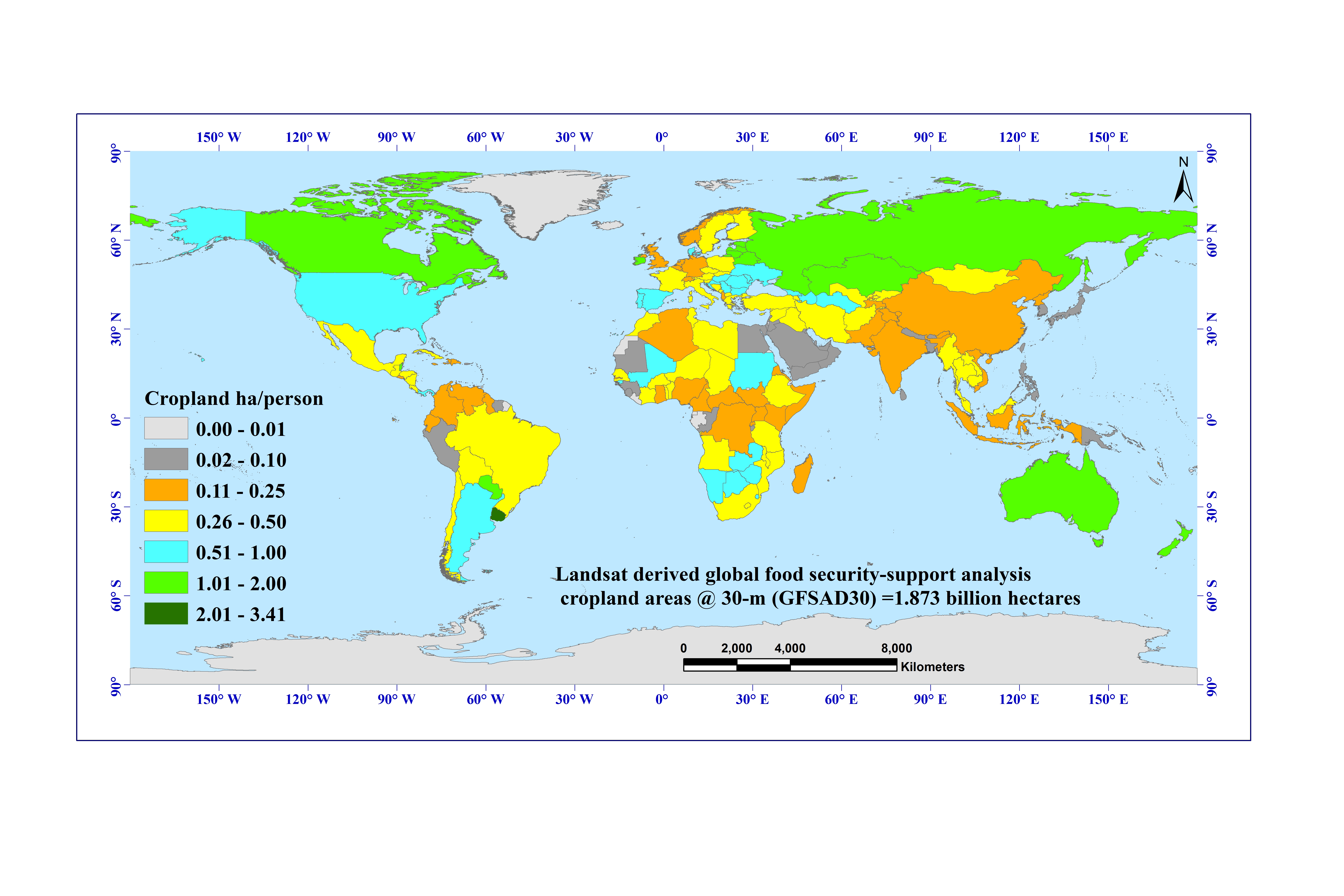
Figure 3. Cropland\hectares per person in each country. Map shows how much cropland area each person has for each country in the world for the nominal year 2015, derived using Landsat 30-m time-series data, machine learning algorithms (e.g., Random Forest, support vector machines, recurssive heirarchical segmentation), and petabyte-scale big-data computing on the Google Earth Engine (GEE) cloud. Croplands as percentage of the total national geographic area. The product is produced for the NASA and USGS funded global food security-support analysis data @ 30-m (GFSAD30). For further details visit:
https://lpdaac.usgs.gov/about/news_archive/release_gfsad_30_meter_cropland_extent_products
Sources/Usage
Courtesy: Teluguntla, P., Thenkabail, P.S, Xiong, J., and Oliphant, A.