
Dauphin Island, Alabama, map views
By St. Petersburg Coastal and Marine Science Center
2005 (approx.)

Detailed Description
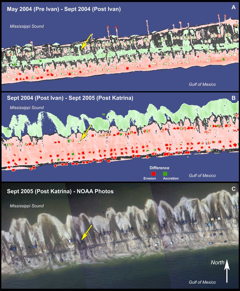
Dauphin Island, Alabama. Map views of post-storm difference grids for Hurricanes Ivan (A) and Katrina (B), and vertical photography of the same location (C). The lidar images show elevation gains (green) and losses (red).
Sources/Usage
Public Domain.
Related

Hurricane Katrina - Pre- and Post-Storm 3D Topography of Dauphin Island
Hurricane Katrina made landfall as a category 3 storm in Plaquemines Parish, Louisiana, on August 29, 2005. The USGS, NASA, the U.S. Army Corps of Engineers, and the University of New Orleans cooperated in a research project investigating coastal change that occurred as a result of Hurricane Katrina.
Related
Hurricane Katrina - Pre- and Post-Storm 3D Topography of Dauphin Island
Hurricane Katrina made landfall as a category 3 storm in Plaquemines Parish, Louisiana, on August 29, 2005. The USGS, NASA, the U.S. Army Corps of Engineers, and the University of New Orleans cooperated in a research project investigating coastal change that occurred as a result of Hurricane Katrina.