
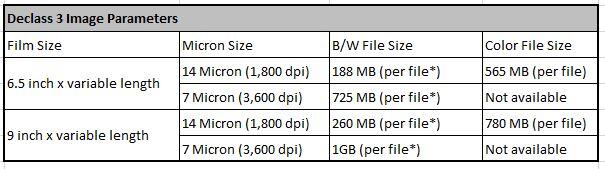
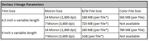
Declassified Satellite Imagery - 3 - Image Parameters Table
By Earth Resources Observation and Science (EROS) Center
2015 (approx.)
Detailed Description
* USGS EROS scans products in overlapping sections and the number of files will vary based on the length of the image. The actual file size may fluctuate due to image data, surrounding metadata, and the addition of the USGS logo.
Sources/Usage
Public Domain.