
DEEP SEARCH 2017
By Wetland and Aquatic Research Center
2017 (approx.)
Detailed Description
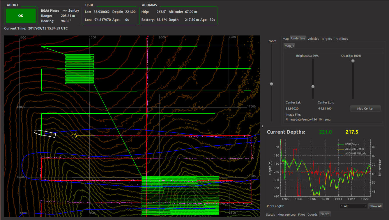
This navigation display shows almost all of the information Sentry engineers need to know that the vehicle is completing its survey properly. The green line shows the programmed track for the survey -- here, long, continuous paths mean Sentry was collecting mapping data while the snake-like box path lines mean the Sentry was taking photos. Completed tracks are shown in red. The Sentry, represented in yellow, can be seen midway through its mapping survey, with the ship, in white, just ahead of it.
Sources/Usage
Image courtesy of DEEP SEARCH 2017, NOAA-OER/BOEM/USGS