
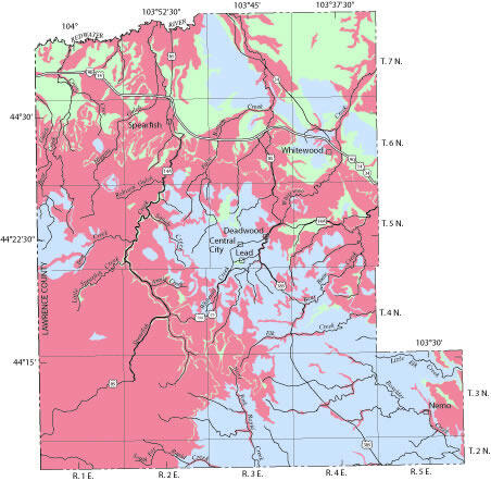
Digital coverages in Lawrence County
Detailed Description
Digital coverages in Lawrence County - sensitivity of ground water to contamination study
Digital data sets were prepared that represent the spatial and attribute information shown on the two plates in the report. Metadata text files are attached to the digital data sets that document georeferencing information and the process steps used in creating the digital data sets.
Downloadable Digital Data representing Sensitivity of Ground Water to Contamination in Lawrence County, SD and associated metadata can be downloaded by clicking on links to archived data sets below.
sd_lcsens_pol - Polygons Representing Sensitivity of Ground Water to Contamination
sd_lcsens_da - Polygons Representing Drainage Areas Upstream from Potential Streamflow-loss Zones
sd_lcsens_lz - Arcs Representing Potential Streamflow-loss Zones
Sources/Usage
Public Domain.