
EAARL-B Pre and Post Bathymetry Elevation

Detailed Description
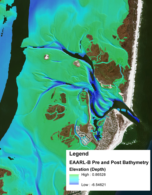
The USGS Coastal and Marine Geology Program in collaboration with USGS National Geospatial Program , is developing three-dimensional (3D) topobathymetric elevation models for the Barnegat Bay estuary and adjacent coastline in New Jersey. Pre- and post-Hurricane Sandy aerial lidar surveys were conducted on Oct. 18-26, 2012 (pre-landfall) and Nov. 1-5, 2012 (post-landfall) with the USGS Experimental Advanced Airborne Research Lidar (EAARL) instrument, which acquires land elevation and water depth data simultaneously. These high-resolution USGS EAARL lidar surveys are key source data to model the submerged topography of Barnegat Bay at an unprecedented level of detail. USGS images created by Jeffrey Danielson.
See the Coastal National Elevation Database (CoNED) Applications Project page for more information.
Sources/Usage
Public Domain.