
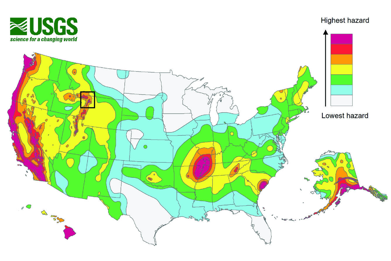
Earthquake hazard map showing peak ground accelerations having a 2 percent proba
Detailed Description
Earthquake hazard map showing peak ground accelerations having a 2 percent probability of being exceeded in 50 years, for a firm rock site. Black box outlines Yellowstone region. The map is based on the most recent USGS models for the conterminous U.S. (2018), Hawaii (1998), and Alaska (2007). The models are based on seismicity and fault-slip rates, and take into account the frequency of earthquakes of various magnitudes. Locally, the hazard may be greater than shown, because site geology may amplify ground motions.