
America at 250, Seen from Space
A new Landsat mosaic captures the full geographic diversity of the United States in a single image
A new Landsat mosaic captures the full geographic diversity of the United States in a single image
From Earth to Sky: How Minerals Create the Dazzling Colors of Independence Day Fireworks
USGS: Lithium in Carolinas Could Replace Imports for a Century or More
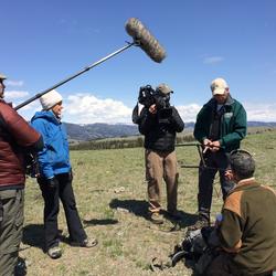
USGS, NASA Map Critical Minerals from 65,000 Feet
Hyperspectral Survey of the West Supports USGS Earth Mapping Resources Initiative
Hyperspectral Survey of the West Supports USGS Earth Mapping Resources Initiative
News
Stay informed on the latest USGS science. From highlights to in‑depth features, our coverage brings you the science that supports communities and decision-makers nationwide.
-
Featured Stories Featured Stories
Browse in-depth stories highlighting the people, projects, and science shaping our organization.
-
News Releases News Releases
Explore our latest announcements, updates, and stories. Use filters to search and sort by topic, date, or location.
-
Science Snippets Science Snippets
Discover updates highlighting findings and insights into the work of the USGS.
-
Technical Announcements Technical Announcements
Find the latest updates on scientific methods, data releases, system changes, and technical guidance from USGS experts.
-
Media Contacts Media Contacts
Connect with USGS media specialists for press inquiries, interviews, and expert information.