
Ecological drought tool for drylands
By Southwest Biological Science Center
September 2021 (approx.)
Detailed Description
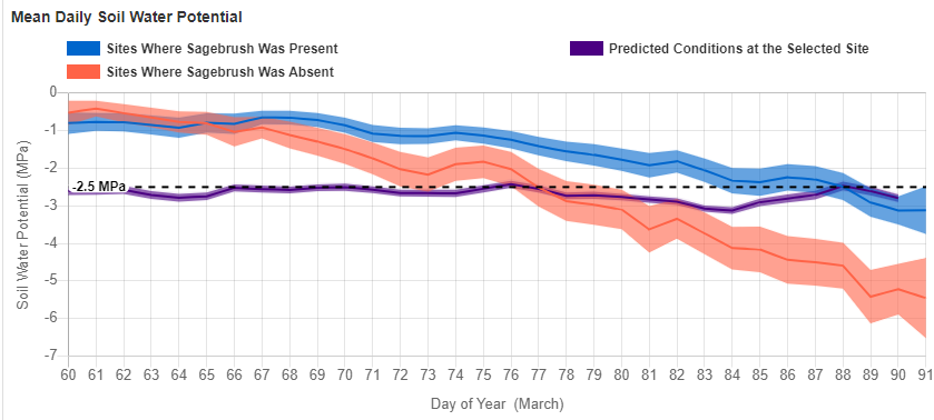
With a project location, the tool provides historic information and forecasts for temperature, precipitation, and soil moisture. To do this, the tool integrates soils data from National Soil Conservation Service (NRCS), seasonal weather forecasts from the National Weather Service, an ecosystem water balance model, and statistical models of plant establishment developed through ecological research. The outputs are forecasts and historical conditions for a specific site selected by the user.
Sources/Usage
Public Domain.