
Enlargements of 1-m AUV bathymetry overlain on 30-m bathymetry grid for the study area along the Cascadia Subduction Zone
Detailed Description
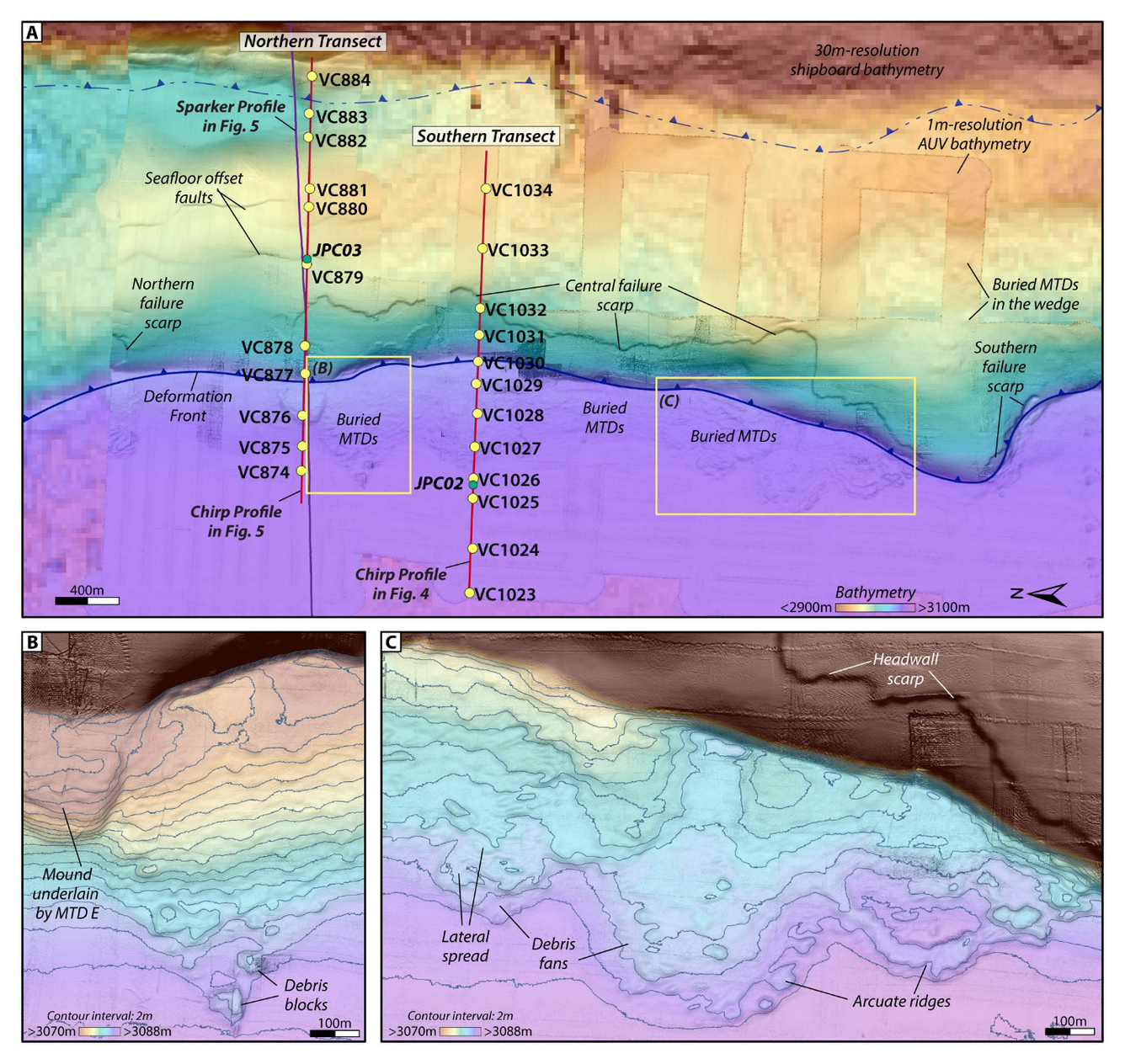
Enlargements of 1-m AUV bathymetry overlain on 30-m bathymetry grid for the study area along the Cascadia Subduction Zone. (A) The AUV bathymetry data reveal a 10m high failure scarp that extends for 4km along the seaward face of the frontal thrust fold. Secondary reverse faults observed in the chirp subbottom data are expressed at the seafloor with ~3m offsets. Two ROV-based vibracore transects (yellow dots) were collected perpendicular to the slope, traversing from the abyssal plain onto the frontal thrust fold in the accretionary wedge. Ship-based piston cores (green dots) were acquired on these transects as well to provide deeper penetration into the subsurface strata. (B) and (C) Enlargements of seafloor bathymetry showing the seafloor expression of the buried mass transport deposits. From the study Widespread abyssal turbidites record megathrust earthquake triggered landslides and coseismic deformation in the Cascadia subduction zone.
Sources/Usage
Public Domain.