



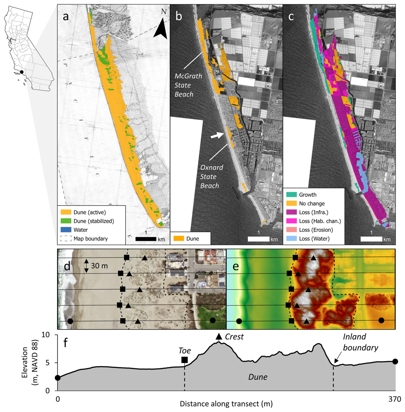
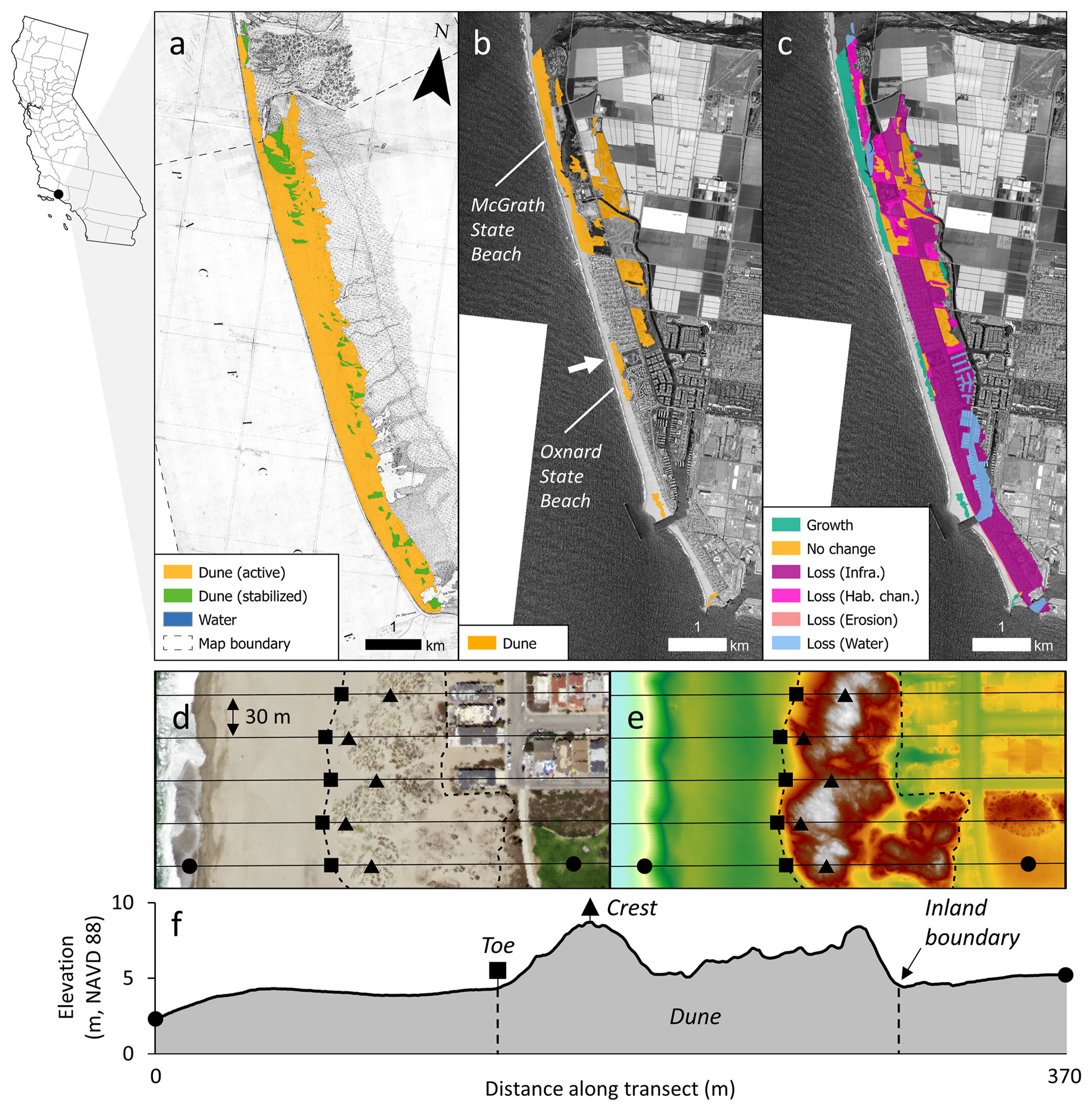
Extent of coastal dunes shown in historical and current topographic surveys in Ventura County, CA


Detailed Description
a) Extent of coastal dunes shown in historical (1855) topographic surveys (T-sheets no. 576 and 682) along McGrath State Beach and Oxnard State Beach, Ventura County. (b) Current (2016) extent of coastal dunes, and (c) drivers of change over time at the same location. (d) High-resolution aerial imagery (NAIP 4-Band Imagery; EROS, 2023) and (e) elevation data (2016 USGS West Coast El-Nino LiDAR digital elevation model, Office for Coastal Management (OCM), 2024a) showing a small section of Oxnard State Beach with the extent of modern (2016) dunes outlined (dashed line), as well as the location of toe (black square) and crest (black triangle) features along five shoreline-perpendicular transects (black lines). (f) An elevation profile of the most southerly transect is also shown. From the study Significant Coastal Dune Loss Challenges California's Climate Resilience and Biodiversity Goals.
Sources/Usage
Public Domain.