
Figure 2 from Farris and others 2026
By Fort Collins Science Center
February 2026 (approx.)

Detailed Description
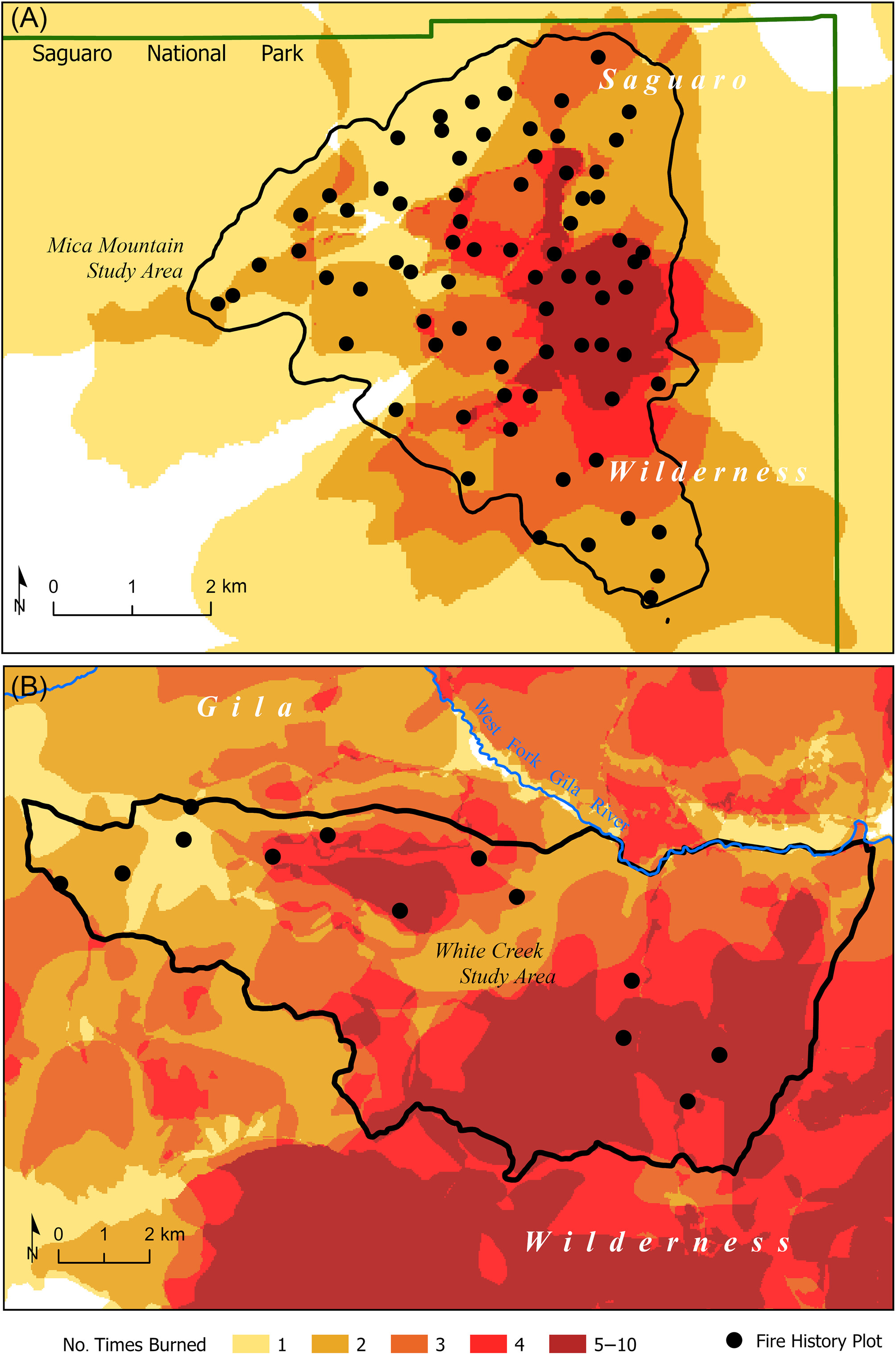
Modern fire frequency derived from fire atlas maps and the locations of tree-ring fire-scar sampling plots in (A) the Saguaro Wilderness study area (SAGU) atop Mica Mountain (2780 ha) in southern Arizona and (B) the Gila Wilderness study area (GILA) in the White Creek Watershed (8186 ha) in southern New Mexico. Fire atlas data cover the period 1937–2016 for Saguaro (maximum number of times burned = 10) and 1909–2016 for Gila (maximum number of times burned = 8).
Sources/Usage
Public Domain.