
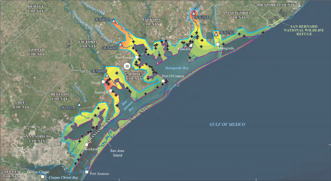
Flood-inundation map from coastal water-surface elevation data, Hurric

Detailed Description
Flood-inundation map from coastal water-surface elevation data for the August and September 2017 Hurricane Harvey-related flood event in southeastern Texas and southwestern Louisiana.
Sources/Usage
Public Domain.
USGS Scientific Investigations Report 2018-5070
Figure 22. Flood-inundation map from coastal water-surface elevation data for the August and September 2017 Hurricane Harvey-related flood
event in southeastern Texas and southwestern Louisiana.
Related

Hurricane Response Science in Oklahoma and Texas
The USGS Oklahoma-Texas Water Science Center (OTWSC) has a hurricane response program which includes a rapid-deployment storm-surge monitor network in advance of hurricanes, real-time monitoring of streamflow throughout the impacted area during a hurricane, and collection of high-water marks and assessment of floods after hurricanes. Visit the links below for more information on our data and...
Related
Hurricane Response Science in Oklahoma and Texas
The USGS Oklahoma-Texas Water Science Center (OTWSC) has a hurricane response program which includes a rapid-deployment storm-surge monitor network in advance of hurricanes, real-time monitoring of streamflow throughout the impacted area during a hurricane, and collection of high-water marks and assessment of floods after hurricanes. Visit the links below for more information on our data and...