
Our Capabilities
We have specialist capabilities for water data collection & dissemination, flood & drought response, water-quality science, and geophysics
Monitor developing conditions
The National Water Dashboard displays streamflow and flooding conditions in context with current weather and hazard conditions.
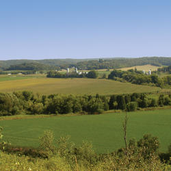
Impacts from oil and natural-gas production
Review of land-use, water-quality, and sediment-quality changes associated with oil and natural-gas production in the Eagle Ford.
Crest-stage data for ungaged west Texas streams
Annual and approximately quarterly peak streamflow data collected from small- to medium-sized watersheds in central and western Texas.
Oklahoma-Texas Water Science Center
Water information is fundamental to national and local economic well-being, protection of life and property, and effective management of water resources. USGS works with partners in Oklahoma and Texas to monitor, assess, conduct targeted research, and deliver information on a wide range of water resources including streamflow, groundwater, water quality, and water use and availability.
Water Dashboard

Oklahoma and Texas real-time stream, lake, reservoir, precipitation, water quality and groundwater stations in context with current weather and hazard conditions
Geophysical Logs

Web based tool for storage and retrieval of borehole-geophysical logs and related data files. USGS scientists can upload geophysical logs to the GeoLog Locator database to be explored through this website.
News
Texas LiDAR-derived StreamStats application now available
Where surface water runs low, groundwater supplements water supply
Fertilizer or foe? Land-applied waste reuse materials and farm-to-fork potential contaminant pathways
Publications
Localization of spatiotemporally heterogeneous subsurface flows using autoencoder-based deep learning framework for time-lapse self-potential tomography Localization of spatiotemporally heterogeneous subsurface flows using autoencoder-based deep learning framework for time-lapse self-potential tomography
Hydrogeologic framework and conceptual groundwater-flow model of the panhandle and northwest parts of the High Plains (Ogallala) aquifer in Oklahoma, 1998–2022 Hydrogeologic framework and conceptual groundwater-flow model of the panhandle and northwest parts of the High Plains (Ogallala) aquifer in Oklahoma, 1998–2022
Assessment of long-term trends in streamflow statistics within and near the Mobile Bay and Perdido Bay watersheds, United States, 1950–2022 Assessment of long-term trends in streamflow statistics within and near the Mobile Bay and Perdido Bay watersheds, United States, 1950–2022
Science
Land application of waste to US farmland: Understanding the scope and environmental implications to aid best practices

Helping Secure Our Nation’s Food Supply: The Intersection of Agriculture, Health, and Environment
