
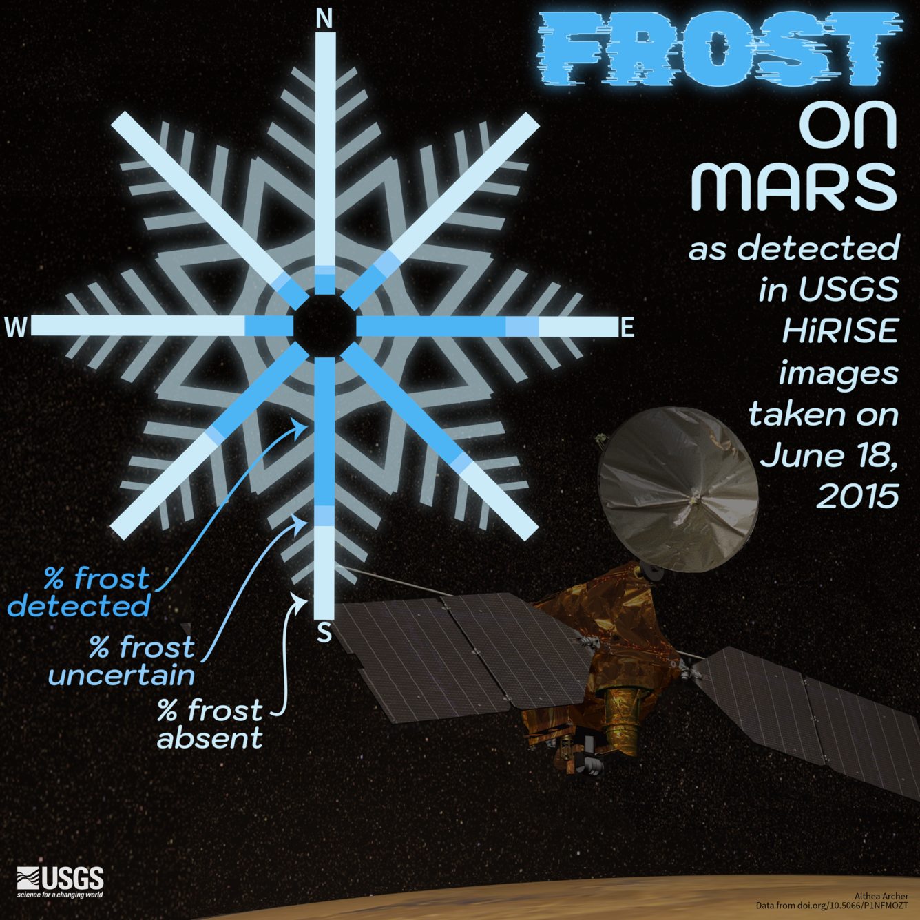
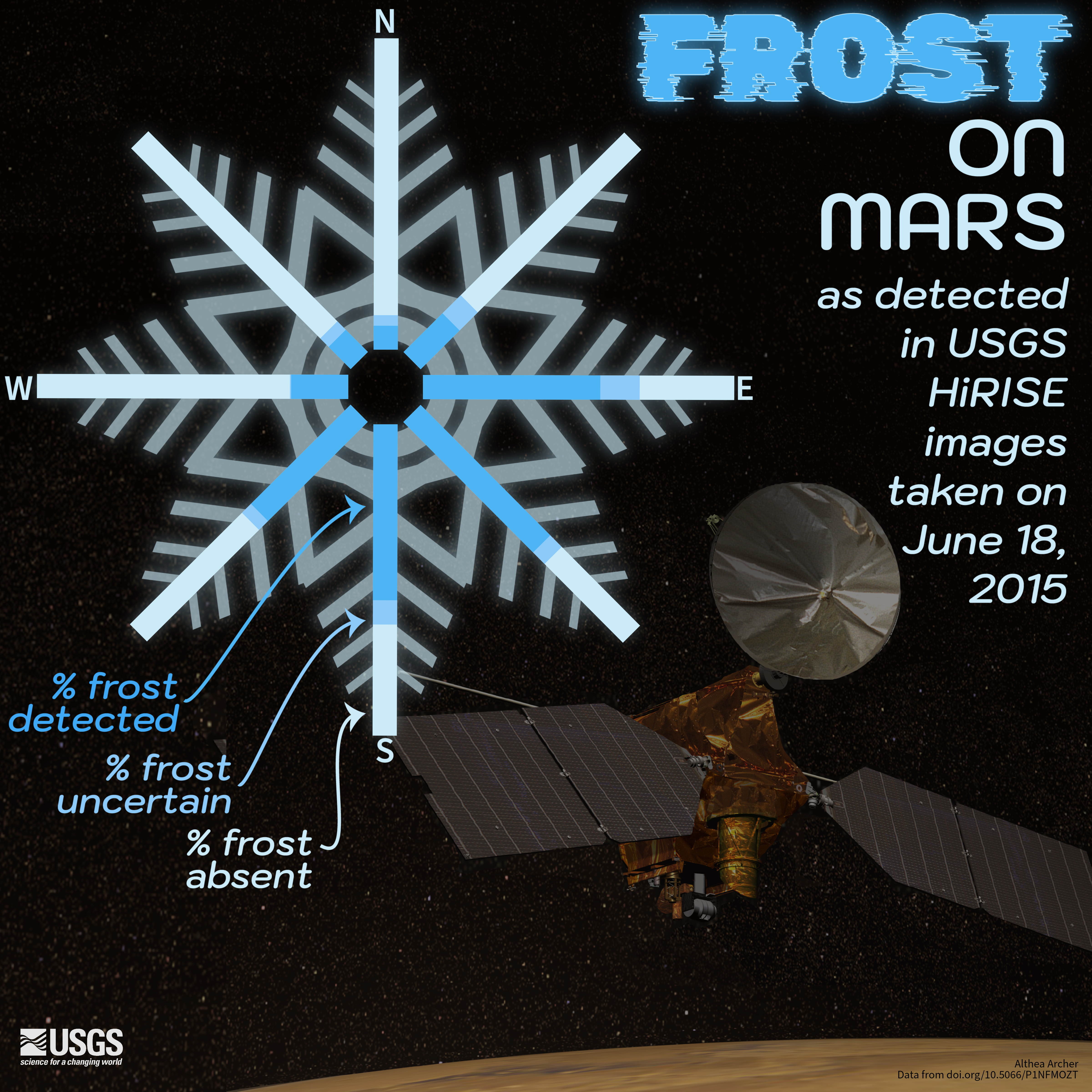
Frost on Mars as detected in USGS HiRISE images taken on June 18, 2016.
Detailed Description
🛰️ 🛰️ Did you know that frost has been detected on Mars!? 🛰️ 🛰️
The USGS Astrogeology Science Center processes and distributes High Resolution Imaging Science Experiment (HiRISE) images and data. The HiRISE system is on board the Mars Reconnaissance Orbiter and has been operating in orbit on Mars since 2006.
Over 1,000 HiRISE images from June 18, 2015, were analyzed for the presence of frost in alcoves and slopes near Martian gully landforms. Each image was partitioned into zones, representing north, northeast, east, southeast, south, southwest, west, and northwest. Of those records with clear imagery, frost was determined to be either present, absent, or uncertain.
Learn more about the HiRISE system and Martian research at the USGS Astrogeology Science Center - https://www.usgs.gov/centers/astrogeology-science-center.
Uncertainty – Extraterrestrial #30DayChartChallenge
Image: Frost on Mars as detected in USGS HiRISE images taken on June 18, 2016. Radial plot representing an 8-sided snowflake shape showing the proportion of sites evaluated for frost that had frost present, uncertain, or absent. The spokes of the snowflake represent the areas of the images that were detected, with the top spoke representing the northern portion of the images and the spokes continuing clockwise in the cardinal directions. Most of the frost detections were seen in the east, southeast, south, and southwest areas of the images.
Sources/Usage
Public Domain.