
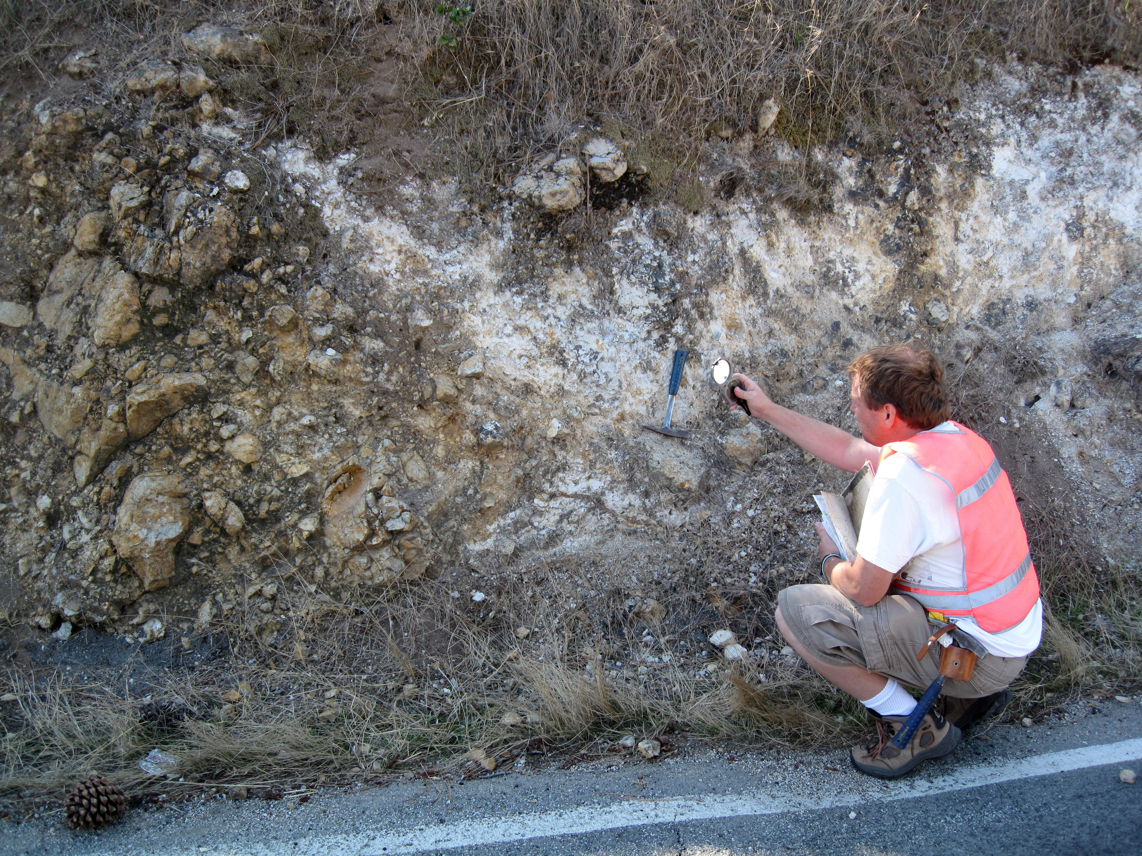
Geologist measuring the dip of Bickmore Canyon Formation near Pinnacle

Detailed Description
Geologist measuring the dip of sedimentary strata near Pinnacles National Park. These rocks are part of the Bickmore Canyon Formation, a late Miocene deposit that currently resides on the west side of the San Andreas fault. The big blocks of granite and volcanic rock on the left side of the photograph indicate that this outcrop formed close to a scarp or cliff that shed debris eastward across the fault. The equivalent material on the east side of the fault, called the Santa Margarita Formation, is now located in the Temblor Range, some 100 miles to the southeast. Measuring the dip of these strata is the first step in projecting these rocks into the subsurface and understanding tectonic forces that have deformed them, the same forces that cause destructive earthquakes in the region.
Sources/Usage
Public Domain.
Related

2D and 3D Geologic Mapping and Earthquake Hazards of California
Related