
Geophysical log - Long Island
Detailed Description
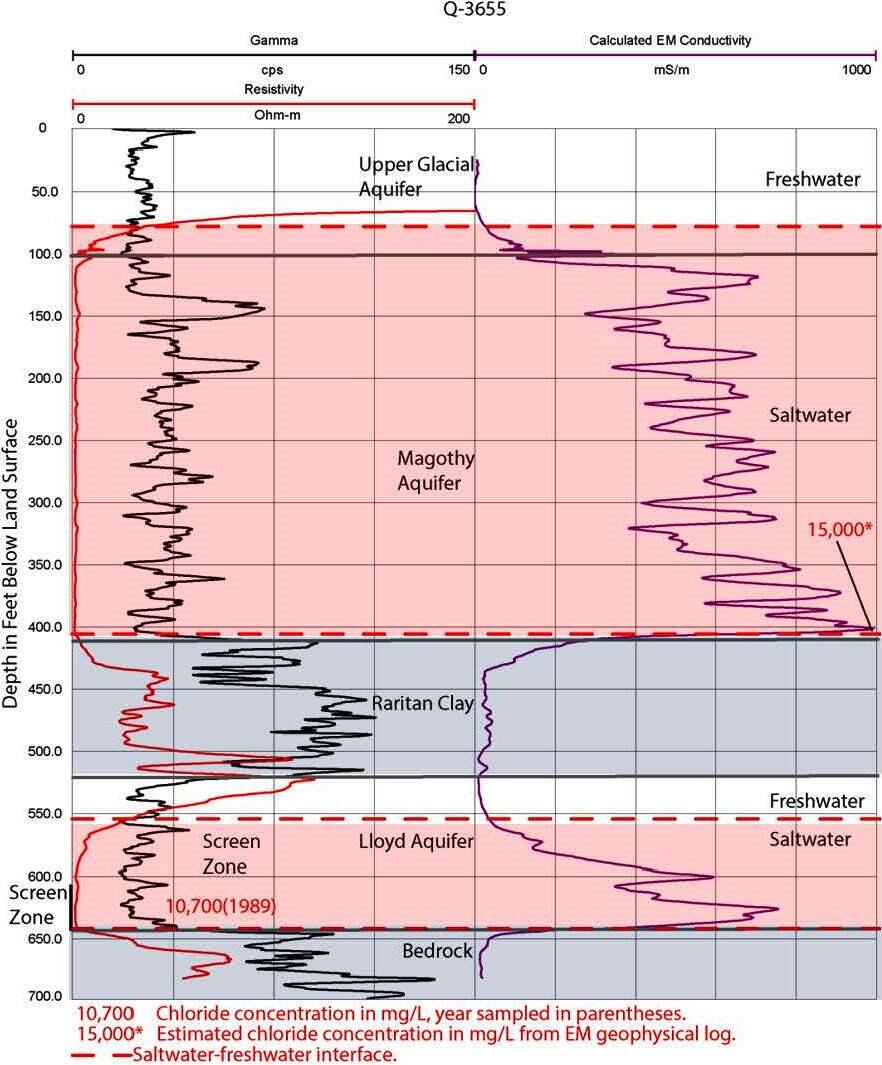
Geophysical Log - Geophysical borehole logging is a technique used to monitor the postition and movement of freshwater-saltwater interface. In this example from a deep well near JFK, there are two wedges of saltwater shown in pink indicationg that in this area; saline groundwater is moving landward in response to groundwater pumping and has intruded the Lloyd and Magothy aquifers.
Sources/Usage
Public Domain.