
Graphs showing gravity records and coincident water-level records
Detailed Description
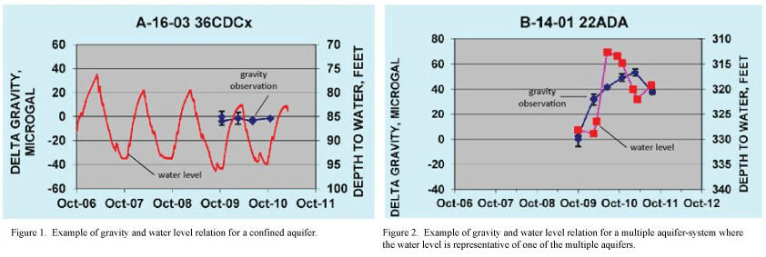
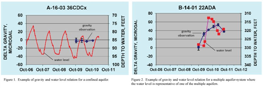
Gravity records when combined with coincident water-level records at well sites can be used to improve understanding of the hydrogeologic conditions and to estimate specific yield of unconfined aquifers.
Figure 1. Example of gravity and water level relation for a confined aquifer.
Figure 2. Example of gravity and water level relation for a multiple aquifer-system where the water level is representative of one of the mutiple aquifers.
Sources/Usage
Public Domain.