
Great Lakes Geologic Mapping Task 1 Photo
By Florence Bascom Geoscience Center
2019 (approx.)

Detailed Description
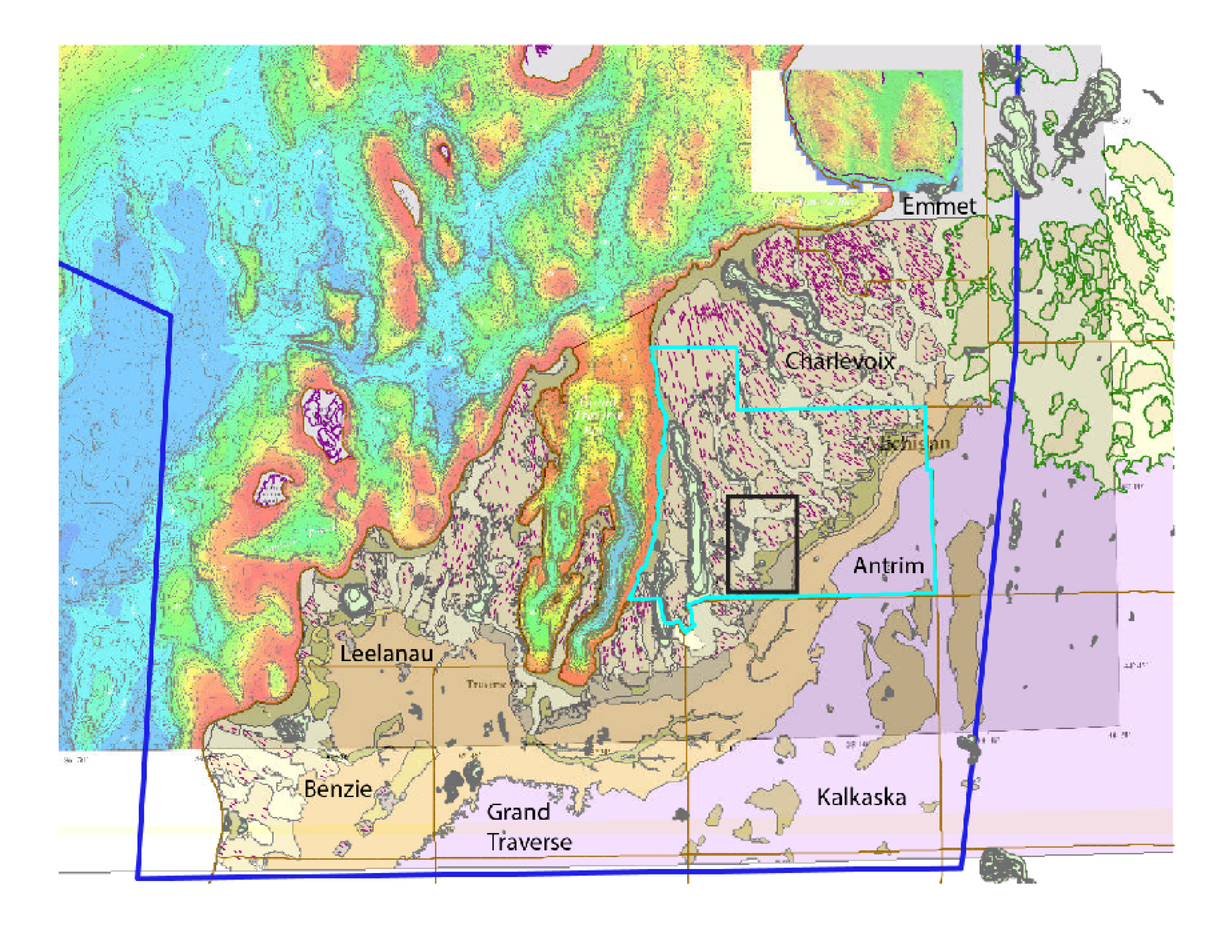
This image was constructed in ArcMap of the ongoing work in Task 1. The onshore lines and polygons were generated by our team and the colored offshore bathymetry in Lake Michigan is publicly available NOAA imagery that was georeferenced by our team.
Sources/Usage
Public Domain.
Related

Task 1-Grand Traverse Bay Quaternary Geologic Mapping
The area encompassed by Task 1 includes the counties around Grand Traverse Bay in Michigan, with focus on Grand Traverse, Antrim, Charlevoix, and Emmet Counties. The primary objective of Task 1 is to produce a seamless, zoomable geologic framework map geodatabase in GeMS format that includes the following data: Quaternary surficial map units on the basis of new LiDAR data; Quaternary sediment...
Related
Task 1-Grand Traverse Bay Quaternary Geologic Mapping
The area encompassed by Task 1 includes the counties around Grand Traverse Bay in Michigan, with focus on Grand Traverse, Antrim, Charlevoix, and Emmet Counties. The primary objective of Task 1 is to produce a seamless, zoomable geologic framework map geodatabase in GeMS format that includes the following data: Quaternary surficial map units on the basis of new LiDAR data; Quaternary sediment...