
Green and Yampa River Data Collection
By Fort Collins Science Center
2024 (approx.)
Detailed Description
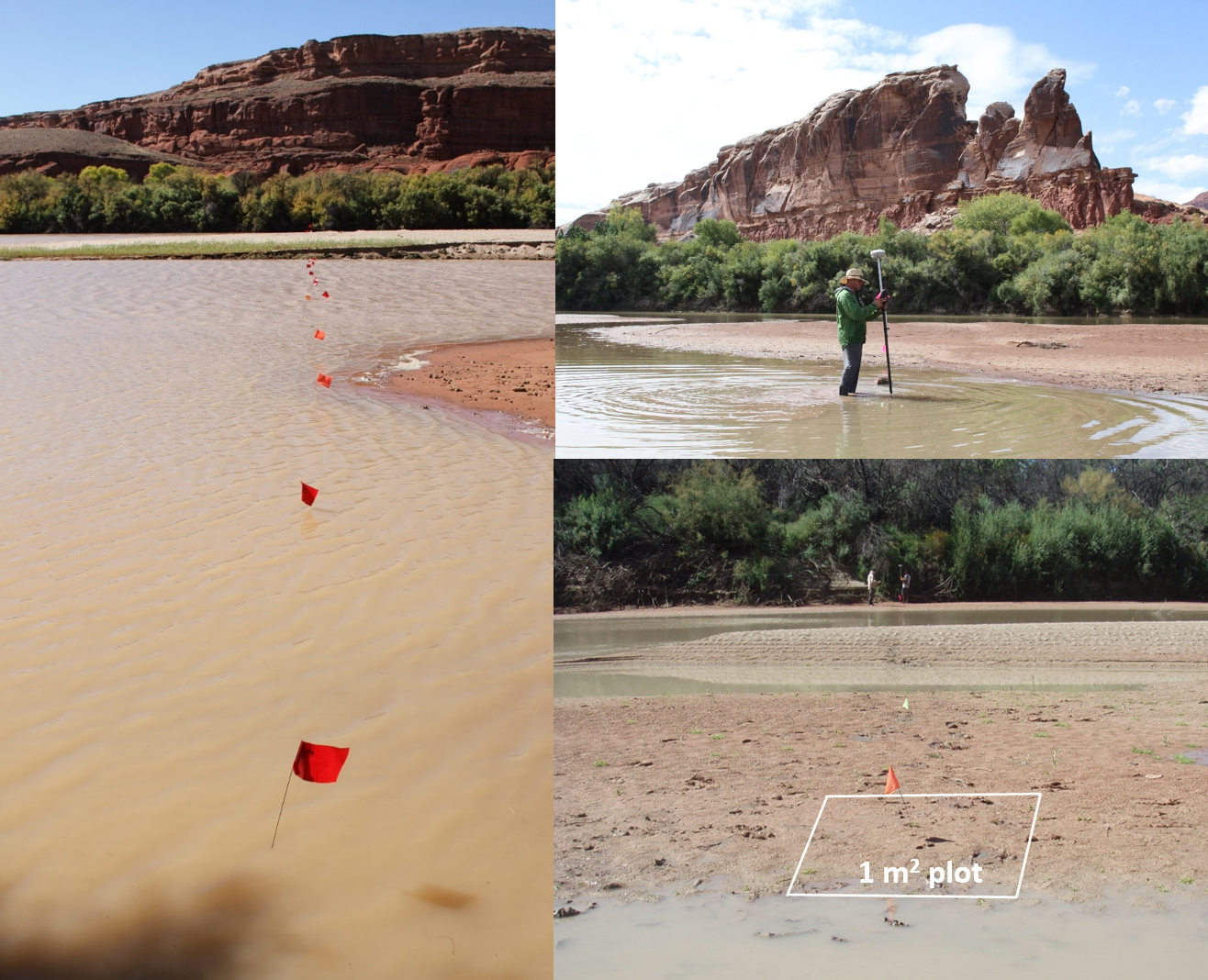
Working with the National Park Service Northern Colorado Plateau Network we are analyzing data from over 20 sites along the Green and Yampa rivers in Utah and Colorado, integrating annual data from thousands of 1-m2 plots, including plant species occurrence, surface elevation and percentage of time under water. This data is being used to inform guidelines for post-2026 management of Colorado River Reservoirs by the Bureau of Reclamation. Photos from National Park Service Northern Colorado Plateau Network.
Sources/Usage
Public Domain.
Related
Ecosystem change science in support of wildfire management, water conservation, public land reclamation, and food security
FORT researchers provide sound science to support the Department of the Interior in its efforts to manage wildfires, conserve water, reclaim public lands for multiple uses, and promote food security. This research is developed in partnership with resource managers from local, State, Federal and Tribal governments, industry, and nongovernmental organizations, empowering local and rural communities...

Integrated River and Riparian Ecosystem Studies
FORT scientists study interactions among river flow, riparian vegetation and channel change at low elevations across the western United States. Cooperators include the National Park Service, Bureau of Land Management, U.S. Fish and Wildlife Service and Bureau of Reclamation. Research areas include reservoir management, control of invasive species, drought response and flood erosion after fires...
Related
Ecosystem change science in support of wildfire management, water conservation, public land reclamation, and food security
FORT researchers provide sound science to support the Department of the Interior in its efforts to manage wildfires, conserve water, reclaim public lands for multiple uses, and promote food security. This research is developed in partnership with resource managers from local, State, Federal and Tribal governments, industry, and nongovernmental organizations, empowering local and rural communities...
Integrated River and Riparian Ecosystem Studies
FORT scientists study interactions among river flow, riparian vegetation and channel change at low elevations across the western United States. Cooperators include the National Park Service, Bureau of Land Management, U.S. Fish and Wildlife Service and Bureau of Reclamation. Research areas include reservoir management, control of invasive species, drought response and flood erosion after fires...