
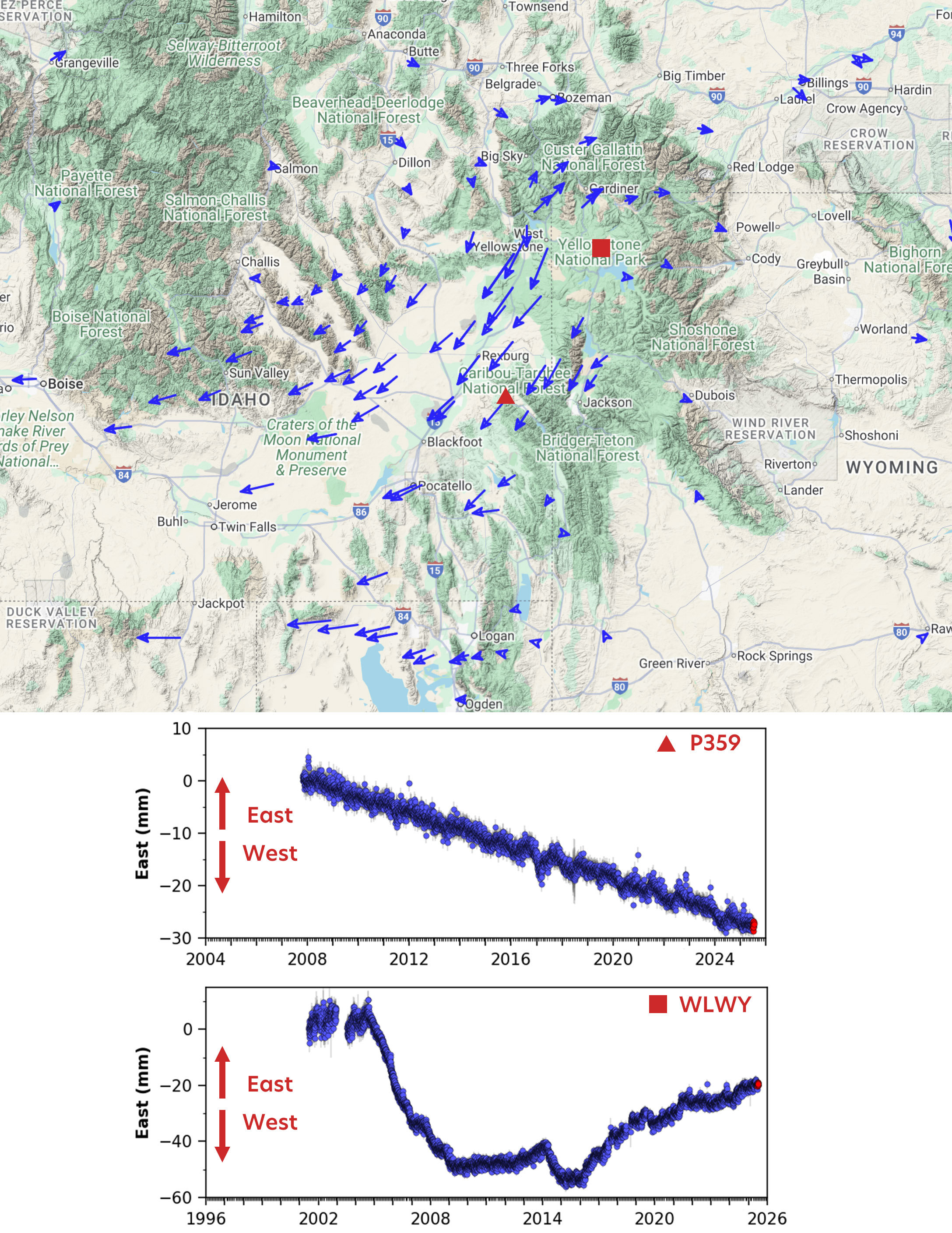
Ground deformation in the Yellowstone area from GPS viewed in a reference frame where North American plate motion has been removed
By Yellowstone Volcano Observatory
July 2025 (approx.)

Detailed Description
In a North American reference frame, where motion of the North American plate has been removed, you can easily see how the GPS stations around the region are moving in slightly different ways. Comparing motion in the east-west direction, station P359 (red triangle southeast of Yellowstone) is consistently moving westward, while station WLWY (red square within the Yellowstone Caldera) has moved back and forth due to caldera inflation and deflation. Figure designed by the EarthScope Consortium.
Sources/Usage
Public Domain.