
Groundwater Nitrogen Flows into Sections Stream Reaches

Detailed Description
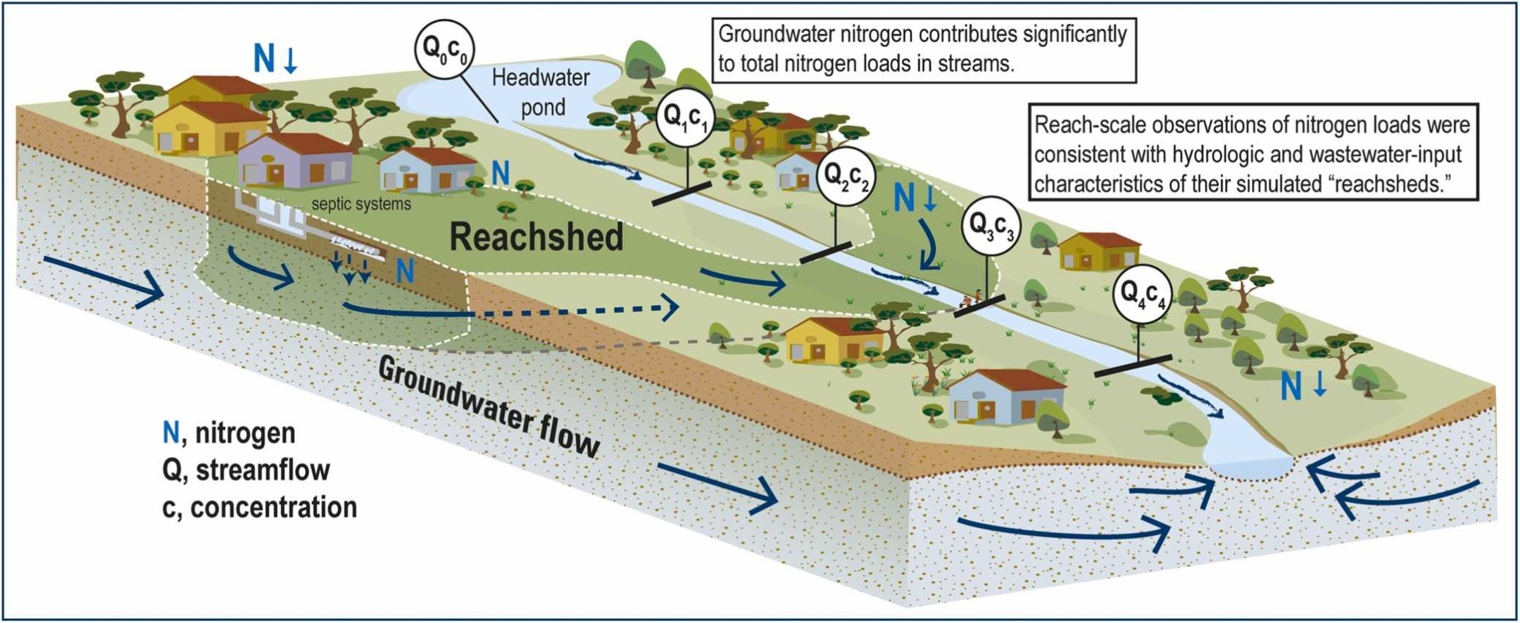
Led by USGS hydrologist Tim McCobb, scientists used a regional groundwater model to map 'reachsheds'— land areas where groundwater recharge contributes to specific stream reaches along 63 stream reaches on Cape Cod. Read the full study.
Sources/Usage
Public Domain.