
How to Interact with the Wildland Fire Trends Tool Perimeter Dashboard

Detailed Description
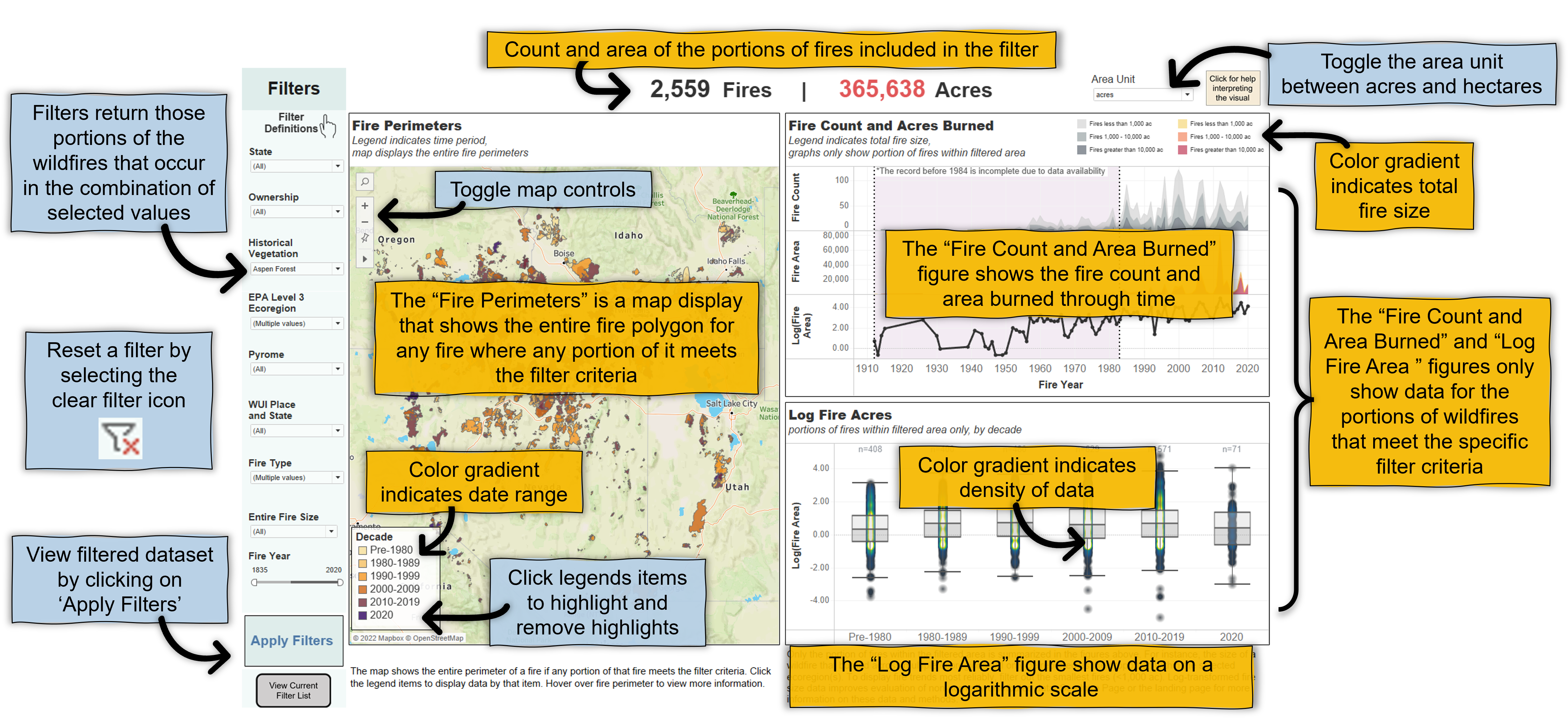
This dashboard displays summary data for portions of wildland fire perimeters (polygons) that occur within the selected filters. To display fire trends, it is recommended to filter out the smallest fires - those less than 1,000 acres. For large queries, please allow the tool a minute to process the request. Wildland Fire Polygons can be downloaded from https://doi.org/10.5066/P9Z2VVRT. See the Introduction page of the tool or http://www.usgs.gov/centers/forest-and-rangeland-ecosystem-science-center/science/wildland-fire-trends-tool for a full list of data sources. Change the dashboard view with the filters. Hover over data for more information in each visualization.
Sources/Usage
Public Domain.
Graphic by Michelle Jeffries
Related

Wildland Fire Trends Tool
The Wildland Fire Trends Tool (WFTT) is a data visualization and analysis tool that calculates and displays wildfire trends and patterns for the western U.S. based on user-defined regions of interest, time periods, and ecosystem types. Users can use the tool to easily generate a variety of maps, graphs, and tabular data products that are informative for all levels of expertise. The WFTT provides...
Related
Wildland Fire Trends Tool
The Wildland Fire Trends Tool (WFTT) is a data visualization and analysis tool that calculates and displays wildfire trends and patterns for the western U.S. based on user-defined regions of interest, time periods, and ecosystem types. Users can use the tool to easily generate a variety of maps, graphs, and tabular data products that are informative for all levels of expertise. The WFTT provides...