
Hurricane Sandy dune-elevation change - Virginia

Detailed Description
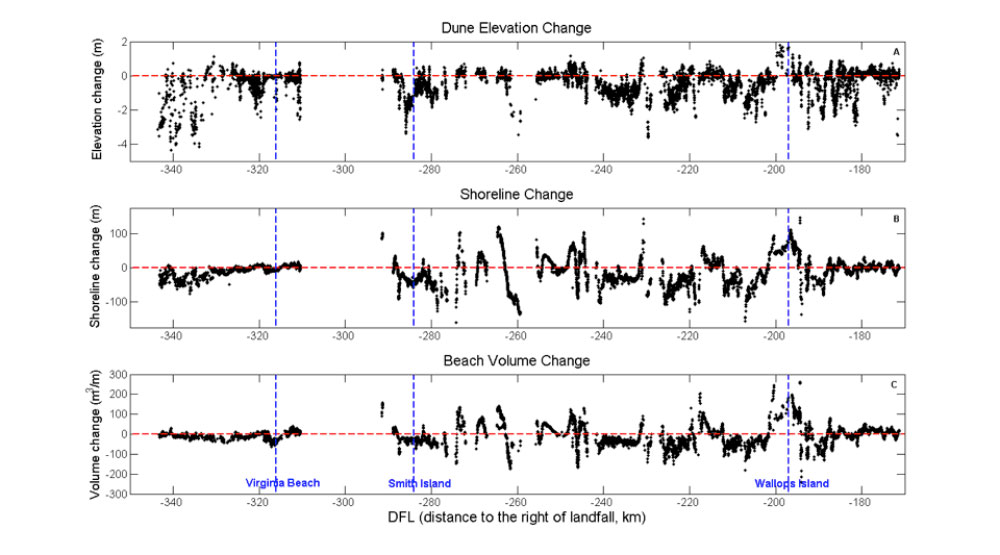
Hurricane Sandy dune-elevation change (A), shoreline change (B), and beach-volume change (C) between November 2009 and November 2012 for the Virginia coast. Vertical dashed lines indicate the center of Virginia Beach, Smith Island, and Wallops Island. Horizontal axis is distance from landfall (DFL) in kilometers where negative numbers indicate areas south of landfall, and positive numbers indicate areas north of landfall.
Sources/Usage
Public Domain.
Related

Hurricane Sandy Response - Storm Impacts and Vulnerability of Coastal Beaches
Scientists evaluated and improved the accuracy of pre-landfall forecasts of storm-induced coastal erosion hazards for Northeast beaches using data from post-Sandy lidar sruveys, beach morphology, and storm hydrodamics.
Related
Hurricane Sandy Response - Storm Impacts and Vulnerability of Coastal Beaches
Scientists evaluated and improved the accuracy of pre-landfall forecasts of storm-induced coastal erosion hazards for Northeast beaches using data from post-Sandy lidar sruveys, beach morphology, and storm hydrodamics.