
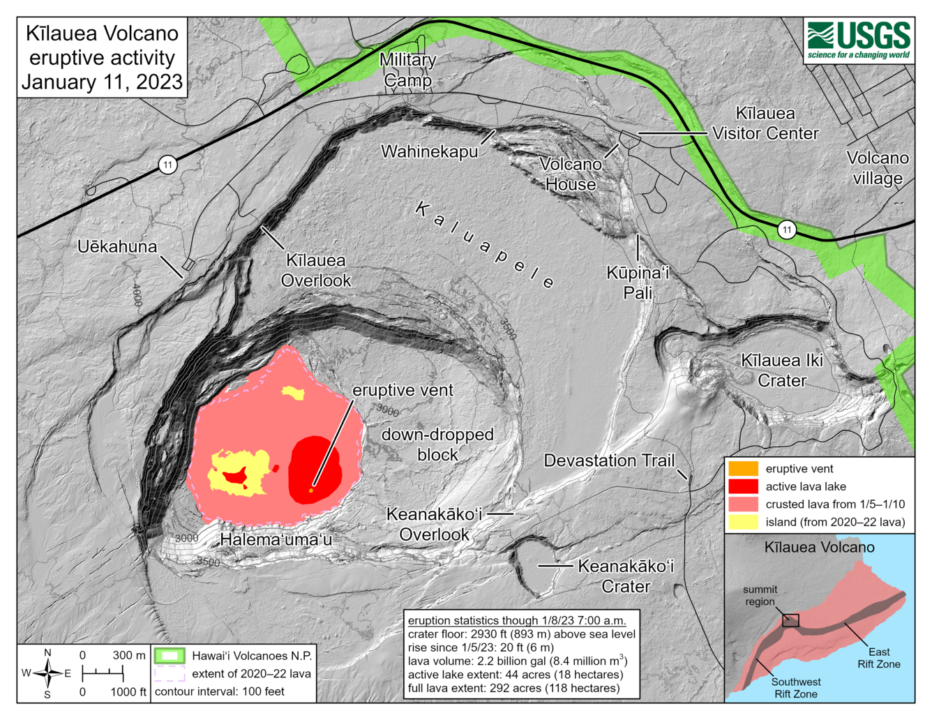
January 11, 2023—Kīlauea summit eruption reference map
Detailed Description
This reference map depicts the Kīlauea summit eruption on January 11, 2023. The provided eruption statistics are derived from helicopter overflight data collected on January 8, 2023, but map features have been updated based on January 11 webcam views. One eruptive vent is active inside Halema‘uma‘u crater, within the actively circulating lava lake (red) on the eastern side of the crater floor. The extent of the active lava lake—the area in red—is 44 acres (18 hectares); part of this area is comprised of the active lava lake footprint from the end of the 2021–22 eruption, which has filled with new lava that upwelled from below. The full extent of new lava from this eruption, totaling both the active lava lake (red) and flows that have crusted over (pink) is 292 acres (118 hectares). Although this eruption has expanded the footprint of post-2018 lava within Halema‘uma‘u crater, citizen scientists may note that this full extent value is smaller than that at the end of the 2021–22 eruption: 295 acres (119 hectares). This discrepancy exists because two higher-standing sections of crater floor (yellow) have not yet been overflowed with new lava.
Sources/Usage
Public Domain.