



July 10, 2026—Kīlauea summit eruption reference map

Detailed Description
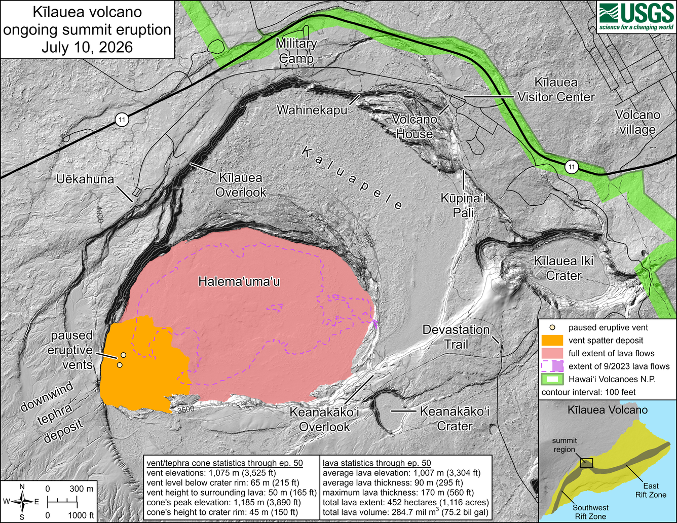
This reference map depicts the Kīlauea summit eruption within Halema‘uma‘u crater that began on December 23, 2024. Most of the data for this map were collected during a USGS Hawaiian Volcano Observatory helicopter overflight on June 30, 2026, so the provided statistics are reflective of the entire eruption through episode 50 on June 27.
Eruptive vent and tephra cone statistics through episode 50:
- Vent elevations: 1,075 meters (3,525 feet)
- Vent level below crater rim: 65 meters (215 feet)
- Vent height to surrounding lava: 50 meters (165 feet)
- Cone's peak elevation: 1,185 meters (3,890 feet)
- Cone's height to crater rim: 45 meters (150 feet)
Lava statistics through episode 50:
- Average lava elevation: 1,007 meters (3,304 feet)
- Average lava thickness: 90 meters (295 feet)
- Maximum lava thickness: 170 meters (560 feet)
- Total lava extent: 452 hectares (1,116 acres)
- Total lava volume: 284.7 million cubic meters (75.2 billion gallons).
Sources/Usage
Public Domain.
Related

Eruption Information
Eruptive activity at the summit of Kīlauea, within Hawaiʻi Volcanoes National Park, has been episodic since an eruption began on December 23, 2024.
Related
Eruption Information
Eruptive activity at the summit of Kīlauea, within Hawaiʻi Volcanoes National Park, has been episodic since an eruption began on December 23, 2024.