
July 2007 Eruption--Quarry flow near-view map: July 25, 2010
Detailed Description
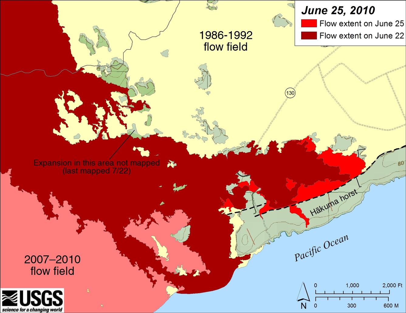
Map showing a close-up view of flow field expansion over the past few days. Light red (lower left corner) is the July 2007 eruption flow field. Reddish-brown is the currently-active Quarry flow as of July 22, 2010, while bright red shows the flow field expansion of the Quarry flow mapped by HVO geologists between July 22 and July 25. (see large map). Lava erupted while Kupaianaha was active from 1986-1992 is shown in light yellow. The currently active flows have been blocked to the south by the north-facing fault scarp that defines the northern edge of the Hakuma horst--a fault block that is raised higher than the surrounding ground. Lava finally topped a low spot in the horst in the past 24 hours, and reached the ocean just after 2 pm today, shortly after this map was made.
Sources/Usage
Public Domain.