
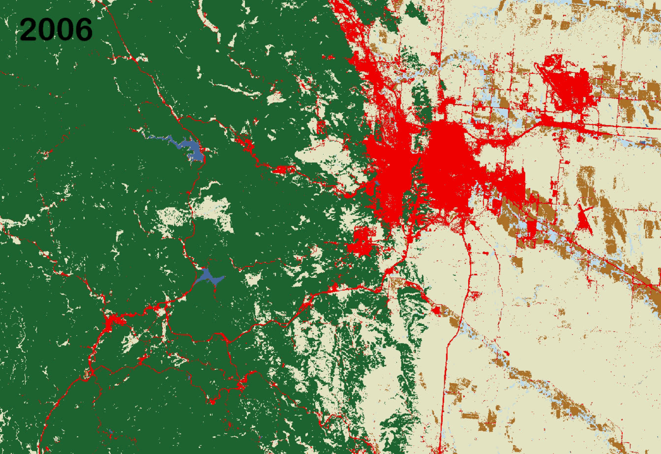
Land Change in the Black Hills - LCMAP
By Earth Resources Observation and Science (EROS) Center
2018 (approx.)

Detailed Description
Animation of land cover change in the Black Hills, created using Land Change Monitoring, Assessment, and Projection data from the USGS Earth Resources Observation and Science (EROS) Center.
Sources/Usage
Public Domain.