
Land Treatment Exploration Tool workflow conceptual model
Detailed Description
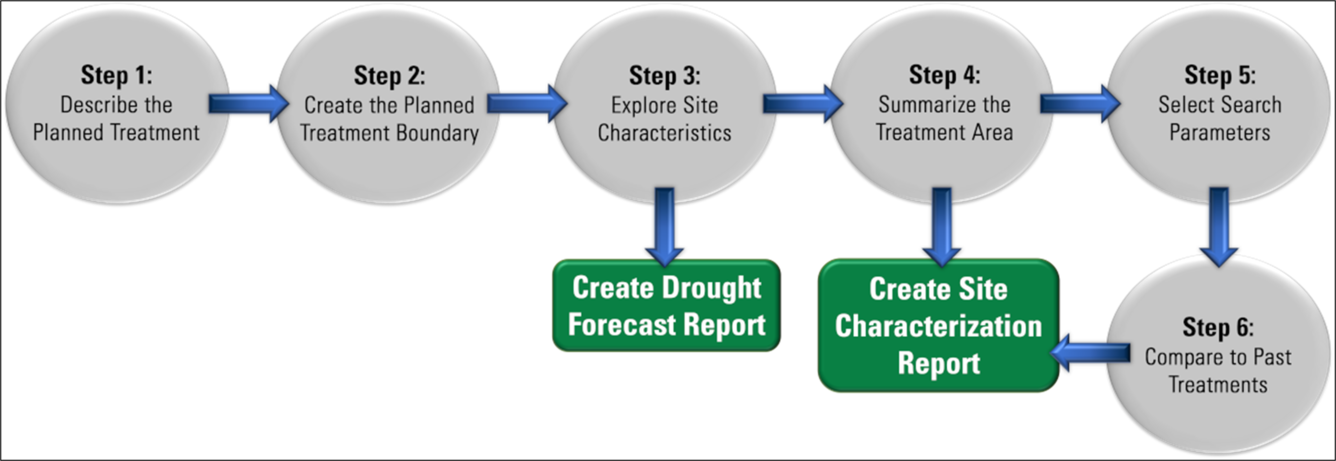
Conceptual diagram of the workflow for the Land Treatment Exploration Tool. Online users can describe the planned treatment, create the planned boundary, explore site characteristics (with the option to create a drought forecast report), summarize the treatment area, select search parameters, and compare to past treatments to create a Site Characterization Report.
Sources/Usage
Public Domain.