
Land Treatment Exploration Tool 3.0 Launch
New Data Layers
Land Treatment Exploration Tool v3.0
New Data Summaries
Land Treatment Exploration Tool v3.0
Full Version Update
The U.S. Geological Survey launched an updated version of the Land Treatment Exploration Tool that includes many new features for a better user experience.
Land Treatment Exploration Tool 3.0 Launch
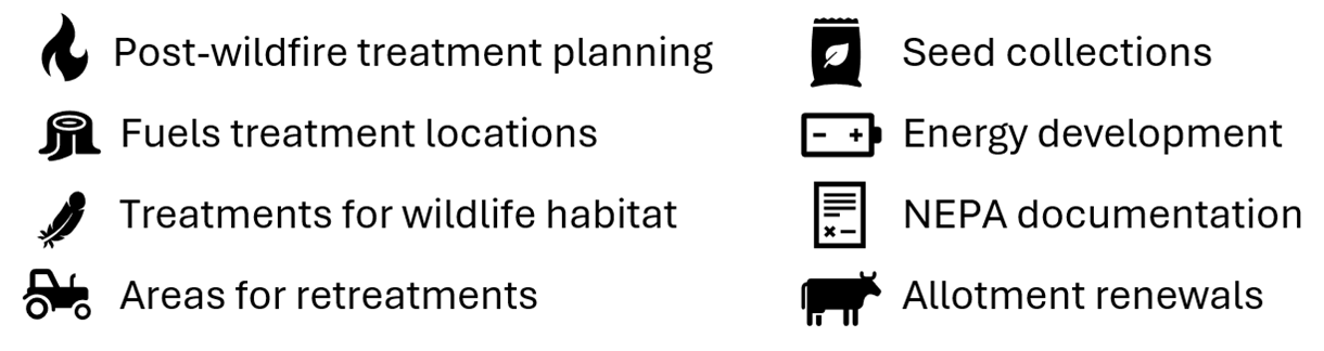
The U.S. Geological Survey partners with the Bureau of Land Management to create and maintain the Land Treatment Exploration Tool to facilitate adaptive management of land treatments. The Exploration Tool taps into the Land Treatment Digital Library, a catalog of information about treatments on public lands administered by the BLM in the western United States. The Land Treatment Exploration Tool is useful beyond just treatment planning.
Example use cases:
The U.S. Geological Survey launched an updated version of the Land Treatment Exploration Tool that includes many new features for a better user experience.
Major release highlights:
- The ability to save and reload progress
- The inclusion of the Rangelands Analysis Platform 10- and 30-meter cover data
- New and updated data sources
- Improved loading indicators
- An upgraded and modern user interface
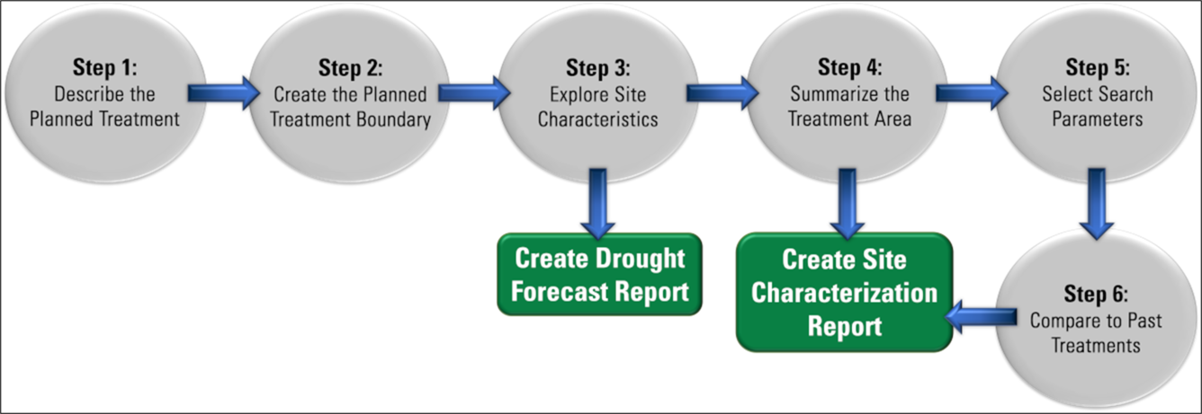
Land Treatment Exploration Tool workflow
Related

Wildlife Ecology and Habitat Restoration Team
Related