
LANDFIRE Existing Vegetation Cover for Montana Counties

Detailed Description
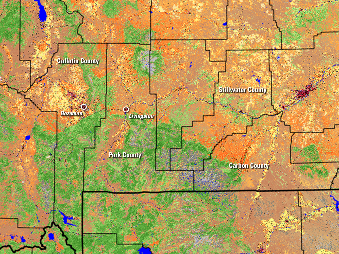
This section from LANDFIRE’s Existing Vegetation Cover (2023) shows the four counties in Montana—Gallatin, Park, Stillwater and Carbon—that commissioned the Trans-County Wildfire Risk Assessment done by Vibrant Planet. LANDFIRE data are a key part of Vibrant Planet’s model. When you explore Existing Vegetation Cover In the LANDFIRE Viewer, clicking on a pixel describes its makeup, in some cases including a percentage of cover. For example, a dark green pixel might show “Tree Cover = 60%”; dark orange, “Herb Cover = 70%”; or light yellow, “Row Crop.” Red and pink colors indicate developed land in towns and cities. This detailed information helps fire managers assess where the most fuel for a potential fire might be located. LANDFIRE products are generated at the U.S. Geological Survey (USGS) Earth Resources Observation and Science (EROS) Center through an interagency partnership between the Department of the Interior and the U.S. Department of Agriculture Forest Service, with The Nature Conservancy as an additional partner.
Sources/Usage
Public Domain.