
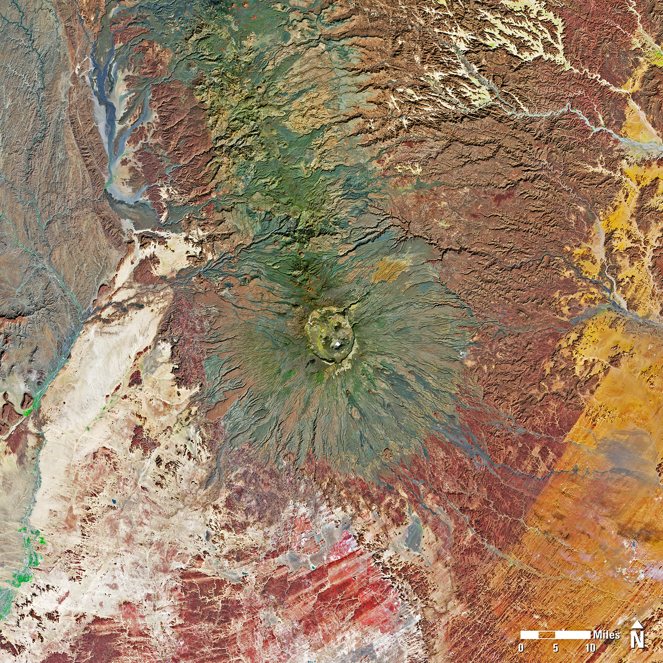
Landsat 9 Image of Emi Koussi in Chad
Detailed Description
Landsat 8 and Landsat 9 kicked off 2025 by acquiring over 1,400 scenes on the first of January. This Landsat 9 image of Emi Koussi in the Tibesti Range of Chad is a mosaic of two of the many scenes collected. Emi Koussi is an extinct shield volcano that rises to 11,204 feet (3,415 meters) above sea level, making it the highest summit in Chad and the Sahara Desert. Two nested calderas form a large, deep depression that is bounded by a distinct rim. The smaller and younger Era Kohor (Trou au Natron du Koussi) caldera is roughly 1.2 miles (2 km) wide and 1,150 feet (350 m) deep. Due to the remote location of Emi Koussi and the arid climate of the region, fieldwork required for geologic mapping of the volcano has been limited. Fortunately, Landsat data have aided scientists in delineating volcanic units and producing geologic maps.
This image is a mosaic of two Landsat scenes:
Landsat 9, Path 183/Row 046, January 1, 2025
Landsat 9, Path 183/Row 047, January 1, 2025
Sources/Usage
Public Domain.