
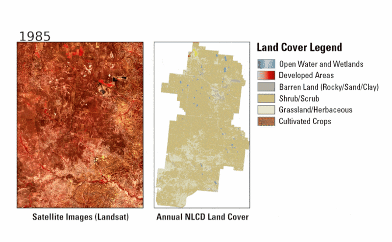
Landsat and Annual NLCD animations of the Powder River Basin area from 1985 to 2024
Altered Content -
The Annual National Land Cover Database (NLCD) uses AI in its processing and mapping production.
Detailed Description
Landsat and Annual NLCD animations of the Powder River Basin area in eastern Wyoming from 1985 to 2024 show areas where mining has begun and has shifted over time. The Annual NLCD land cover animation shows how the landscape was shrub/scrub (such as sagebrush) and grassland, then some of those areas were barren for years and went back to vegetation when mine operations were completed. The Landsat images show those same details, but you can also see the open pits being created and then refilled over time.
Sources/Usage
Public Domain.